

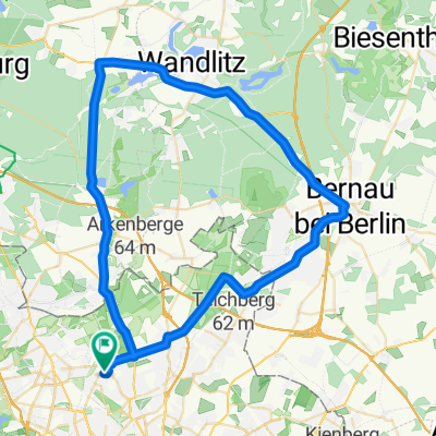
Rosenthal-Tegel-Havelbaude
A cycling route starting in Rosenthal, State of Berlin, Germany.
Overview
About this route
Rosenthal - Tegel Havelbaude (Hohenneuendorf) - Schönfließ - Rosenthal
- -:--
- Duration
- 44.5 km
- Distance
- 98 m
- Ascent
- 94 m
- Descent
- ---
- Avg. speed
- ---
- Max. altitude
Route quality
Waytypes & surfaces along the route
Waytypes
Quiet road
8 km
(18 %)
Path
7.1 km
(16 %)
Surfaces
Paved
36.5 km
(82 %)
Unpaved
1.3 km
(3 %)
Asphalt
34.7 km
(78 %)
Concrete
1.8 km
(4 %)
Continue with Bikemap
Use, edit, or download this cycling route
You would like to ride Rosenthal-Tegel-Havelbaude or customize it for your own trip? Here is what you can do with this Bikemap route:
Free features
- Save this route as favorite or in collections
- Copy & plan your own version of this route
- Sync your route with Garmin or Wahoo
Premium features
Free trial for 3 days, or one-time payment. More about Bikemap Premium.
- Navigate this route on iOS & Android
- Export a GPX / KML file of this route
- Create your custom printout (try it for free)
- Download this route for offline navigation
Discover more Premium features.
Get Bikemap PremiumFrom our community
Other popular routes starting in Rosenthal
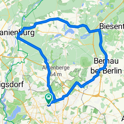
 Pankow - Grünheide - Oderbruch - Straußberg -Pankow
- Distance
- 232.6 km
- Ascent
- 321 m
- Descent
- 321 m
- Location
- Rosenthal, State of Berlin, Germany
 Rosenthal - Ladeburg
- Distance
- 23.9 km
- Ascent
- 75 m
- Descent
- 32 m
- Location
- Rosenthal, State of Berlin, Germany
 Pankow -Wenisckendorf - Bernau (Trainigsrunde)
- Distance
- 58.1 km
- Ascent
- 130 m
- Descent
- 118 m
- Location
- Rosenthal, State of Berlin, Germany
 Rosenthal - Haßleben - Woldegk
- Distance
- 113.8 km
- Ascent
- 210 m
- Descent
- 140 m
- Location
- Rosenthal, State of Berlin, Germany
 20160720_182536.gpx
- Distance
- 15.1 km
- Ascent
- 25 m
- Descent
- 22 m
- Location
- Rosenthal, State of Berlin, Germany
 Rosenthal - Wutzsee
- Distance
- 79.4 km
- Ascent
- 137 m
- Descent
- 138 m
- Location
- Rosenthal, State of Berlin, Germany
 Pankow - Oranienburg - Lanke - Bernau
- Distance
- 76.8 km
- Ascent
- 256 m
- Descent
- 246 m
- Location
- Rosenthal, State of Berlin, Germany
 FamilienTour
- Distance
- 17.6 km
- Ascent
- 55 m
- Descent
- 58 m
- Location
- Rosenthal, State of Berlin, Germany
Open it in the app