Engen 677km 7510hm Vidajoch-Stilfserjoch
- 677.1 km
- 5,813 m
- 5,813 m
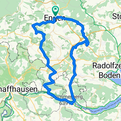
- Engen, Baden-Wurttemberg, Germany
A cycling route starting in Engen, Baden-Wurttemberg, Germany.
Overview
Circular route Engen, Bittelbrunn, Engen through the pampa
created this 11 years ago
Route quality
Track
5.7 km
(53 %)
Quiet road
2.4 km
(22 %)
Paved
3.9 km
(36 %)
Unpaved
5.5 km
(51 %)
Gravel
3.2 km
(30 %)
Asphalt
3 km
(28 %)
Continue with Bikemap
You would like to ride Engen-Bittelbrunn-Engen or customize it for your own trip? Here is what you can do with this Bikemap route:
Free trial for 3 days, or one-time payment. More about Bikemap Premium.
Discover more Premium features.
Get Bikemap PremiumFrom our community
Open it in the app