

Weilheim-Tannheimer Tal
A cycling route starting in Weilheim, Bavaria, Germany.
Overview
About this route
Long tour with grand views
- -:--
- Duration
- 232.9 km
- Distance
- 2,963 m
- Ascent
- 2,800 m
- Descent
- ---
- Avg. speed
- 1,183 m
- Max. altitude
Route quality
Waytypes & surfaces along the route
Waytypes
Road
23.3 km
(10 %)
Track
21 km
(9 %)
Surfaces
Paved
198 km
(85 %)
Unpaved
11.6 km
(5 %)
Asphalt
193.3 km
(83 %)
Gravel
7 km
(3 %)
Continue with Bikemap
Use, edit, or download this cycling route
You would like to ride Weilheim-Tannheimer Tal or customize it for your own trip? Here is what you can do with this Bikemap route:
Free features
- Save this route as favorite or in collections
- Copy & plan your own version of this route
- Split it into stages to create a multi-day tour
- Sync your route with Garmin or Wahoo
Premium features
Free trial for 3 days, or one-time payment. More about Bikemap Premium.
- Navigate this route on iOS & Android
- Export a GPX / KML file of this route
- Create your custom printout (try it for free)
- Download this route for offline navigation
Discover more Premium features.
Get Bikemap PremiumFrom our community
Other popular routes starting in Weilheim
 Weilheim-Antdorf
- Distance
- 62.3 km
- Ascent
- 754 m
- Descent
- 755 m
- Location
- Weilheim, Bavaria, Germany
 Easy ride in Weilheim i.OB
- Distance
- 3.2 km
- Ascent
- 97 m
- Descent
- 102 m
- Location
- Weilheim, Bavaria, Germany
 Weilheim in OB zum Staffelsee und über Wiesen und Felder zurück
- Distance
- 58.3 km
- Ascent
- 1,968 m
- Descent
- 1,967 m
- Location
- Weilheim, Bavaria, Germany
 Weilheim-Peiting
- Distance
- 53.2 km
- Ascent
- 699 m
- Descent
- 701 m
- Location
- Weilheim, Bavaria, Germany
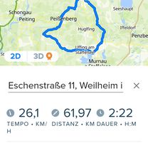
 Schwaigerstraße 7, Weilheim i.OB nach Veilchenweg 4, Weilheim i.OB
- Distance
- 36.3 km
- Ascent
- 1,183 m
- Descent
- 1,122 m
- Location
- Weilheim, Bavaria, Germany
 Trainingsroute Weilheim - Raisting
- Distance
- 21.5 km
- Ascent
- 161 m
- Descent
- 164 m
- Location
- Weilheim, Bavaria, Germany
 RR WM - UFFING - BÖBING - WM
- Distance
- 62 km
- Ascent
- 485 m
- Descent
- 500 m
- Location
- Weilheim, Bavaria, Germany
 Weilheim-Tannheimer Tal
- Distance
- 232.9 km
- Ascent
- 2,963 m
- Descent
- 2,800 m
- Location
- Weilheim, Bavaria, Germany
Open it in the app