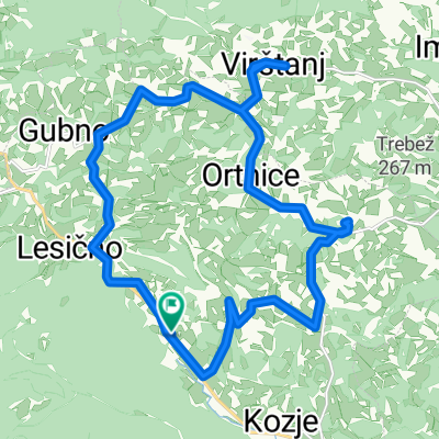
Okič-Zagorje-Planina-Jurklošter-Vrh-Laško-Rifengozd-Celje
A cycling route starting in Kozje, Kozje, Slovenia.
Overview
About this route
Krajša in precej razgibana tura po obronkih Kozjanskega, popolnoma neprometna do Laškega.
- -:--
- Duration
- 55 km
- Distance
- 725 m
- Ascent
- 908 m
- Descent
- ---
- Avg. speed
- ---
- Avg. speed
Route quality
Waytypes & surfaces along the route
Waytypes
Quiet road
32.4 km
(59 %)
Road
17 km
(31 %)
Surfaces
Paved
31.6 km
(57 %)
Paved (undefined)
21.8 km
(40 %)
Asphalt
9.8 km
(18 %)
Undefined
23.5 km
(43 %)
Continue with Bikemap
Use, edit, or download this cycling route
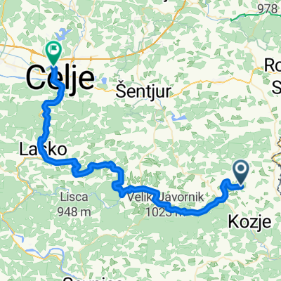
You would like to ride Okič-Zagorje-Planina-Jurklošter-Vrh-Laško-Rifengozd-Celje or customize it for your own trip? Here is what you can do with this Bikemap route:
Free features
- Save this route as favorite or in collections
- Copy & plan your own version of this route
- Sync your route with Garmin or Wahoo
Premium features
Free trial for 3 days, or one-time payment. More about Bikemap Premium.
- Navigate this route on iOS & Android
- Export a GPX / KML file of this route
- Create your custom printout (try it for free)
- Download this route for offline navigation
Discover more Premium features.
Get Bikemap PremiumFrom our community
Other popular routes starting in Kozje
- Krivica-Virštajn
- Distance
- 6.2 km
- Ascent
- 51 m
- Descent
- 194 m
- Location
- Kozje, Kozje, Slovenia
- POT GRADOV PODČETRTEK
- Distance
- 54.5 km
- Ascent
- 790 m
- Descent
- 793 m
- Location
- Kozje, Kozje, Slovenia
- DOS-jugovzhod-Kozjansko-NM-Kočevje-Cerknica-LJ
- Distance
- 288 km
- Ascent
- 1,475 m
- Descent
- 1,617 m
- Location
- Kozje, Kozje, Slovenia
- Drensko Rebro-Podčetrtek-Rudnica-Javoršica-Gubno-Kozje
- Distance
- 36.7 km
- Ascent
- 676 m
- Descent
- 816 m
- Location
- Kozje, Kozje, Slovenia
- Bohor iz Kozjega
- Distance
- 34.6 km
- Ascent
- 937 m
- Descent
- 937 m
- Location
- Kozje, Kozje, Slovenia
- Kozje-Vetrnik-V.Kamen-Sremič-Globoko-Pavlova vas-Podsreda
- Distance
- 73.5 km
- Ascent
- 1,428 m
- Descent
- 1,428 m
- Location
- Kozje, Kozje, Slovenia
- Kozjansko - HR Zagorje - R. Slatina
- Distance
- 62.1 km
- Ascent
- 510 m
- Descent
- 680 m
- Location
- Kozje, Kozje, Slovenia
- Okič-Zagorje-Planina-Jurklošter-Vrh-Laško-Rifengozd-Celje
- Distance
- 55 km
- Ascent
- 725 m
- Descent
- 908 m
- Location
- Kozje, Kozje, Slovenia
Open it in the app