
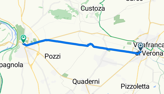
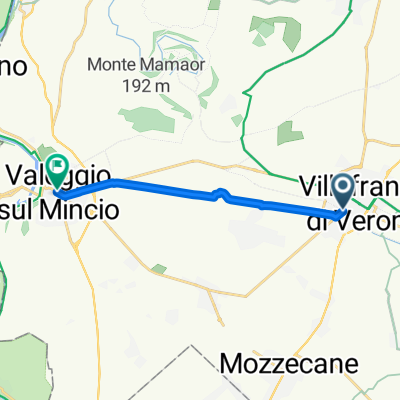
Terre del Custoza: Villafranca di Verona - Valeggio sul Mincio
A cycling route starting in Villafranca di Verona, Veneto, Italy.
Overview
About this route
da Villafranca di Verona a Valeggio sul Mincio; interamente tabellato; in pianura in ambito agricolo, prima parte fino a Dossi Prabiano su percorso ciclabile separato.
- -:--
- Duration
- 8.6 km
- Distance
- 38 m
- Ascent
- 0 m
- Descent
- ---
- Avg. speed
- ---
- Max. altitude
Route quality
Waytypes & surfaces along the route
Waytypes
Quiet road
2.3 km
(27 %)
Busy road
1.6 km
(19 %)
Surfaces
Paved
6.8 km
(79 %)
Unpaved
1.4 km
(16 %)
Asphalt
6.8 km
(79 %)
Gravel
1.4 km
(16 %)
Undefined
0.4 km
(5 %)
Continue with Bikemap
Use, edit, or download this cycling route
You would like to ride Terre del Custoza: Villafranca di Verona - Valeggio sul Mincio or customize it for your own trip? Here is what you can do with this Bikemap route:
Free features
- Save this route as favorite or in collections
- Copy & plan your own version of this route
- Sync your route with Garmin or Wahoo
Premium features
Free trial for 3 days, or one-time payment. More about Bikemap Premium.
- Navigate this route on iOS & Android
- Export a GPX / KML file of this route
- Create your custom printout (try it for free)
- Download this route for offline navigation
Discover more Premium features.
Get Bikemap PremiumFrom our community
Other popular routes starting in Villafranca di Verona
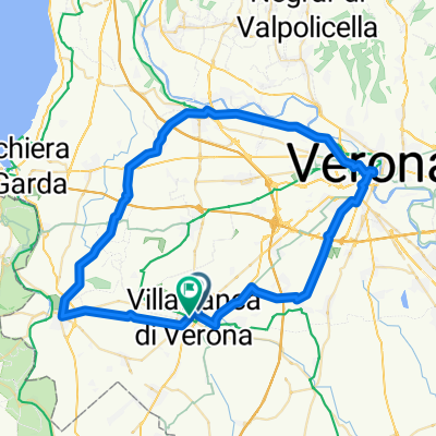
 Villafranca di Verona-Mantova
- Distance
- 102.9 km
- Ascent
- 50 m
- Descent
- 83 m
- Location
- Villafranca di Verona, Veneto, Italy
 PUNTA VELENO DA VILLAFRANCA
- Distance
- 116.1 km
- Ascent
- 1,712 m
- Descent
- 1,712 m
- Location
- Villafranca di Verona, Veneto, Italy
 PERCORSO X MTB - MISTO (asfal-sterr-alcuni pass.in erba)
- Distance
- 44.7 km
- Ascent
- 224 m
- Descent
- 222 m
- Location
- Villafranca di Verona, Veneto, Italy
 Terre del Custoza: Villafranca di Verona - Valeggio sul Mincio
- Distance
- 8.6 km
- Ascent
- 38 m
- Descent
- 0 m
- Location
- Villafranca di Verona, Veneto, Italy
 PERCORSO CORSA MTBVILLAFRANCA
- Distance
- 7.4 km
- Ascent
- 178 m
- Descent
- 175 m
- Location
- Villafranca di Verona, Veneto, Italy
 anello veronese
- Distance
- 60.4 km
- Ascent
- 192 m
- Descent
- 190 m
- Location
- Villafranca di Verona, Veneto, Italy
 Villafranca_San.Benedetto
- Distance
- 54.7 km
- Ascent
- 131 m
- Descent
- 129 m
- Location
- Villafranca di Verona, Veneto, Italy
 Tour 7
- Distance
- 37 km
- Ascent
- 161 m
- Descent
- 147 m
- Location
- Villafranca di Verona, Veneto, Italy
Open it in the app