

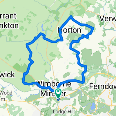
BHF 50 Mile
A cycling route starting in Wimborne Minster, England, United Kingdom.
Overview
About this route
2014 50 Mile Route for British Heart Foundation
- -:--
- Duration
- 78.2 km
- Distance
- 331 m
- Ascent
- 331 m
- Descent
- ---
- Avg. speed
- ---
- Max. altitude
Route quality
Waytypes & surfaces along the route
Waytypes
Quiet road
39.9 km
(51 %)
Road
28.2 km
(36 %)
Surfaces
Paved
20.3 km
(26 %)
Asphalt
20.3 km
(26 %)
Undefined
57.9 km
(74 %)
Continue with Bikemap
Use, edit, or download this cycling route
You would like to ride BHF 50 Mile or customize it for your own trip? Here is what you can do with this Bikemap route:
Free features
- Save this route as favorite or in collections
- Copy & plan your own version of this route
- Sync your route with Garmin or Wahoo
Premium features
Free trial for 3 days, or one-time payment. More about Bikemap Premium.
- Navigate this route on iOS & Android
- Export a GPX / KML file of this route
- Create your custom printout (try it for free)
- Download this route for offline navigation
Discover more Premium features.
Get Bikemap PremiumFrom our community
Other popular routes starting in Wimborne Minster
 Stoney Down single track (hard to follow in forest) but fun.
- Distance
- 21.5 km
- Ascent
- 209 m
- Descent
- 209 m
- Location
- Wimborne Minster, England, United Kingdom
 Willet Arms - Upton House - Bournemouth Pier
- Distance
- 36.4 km
- Ascent
- 146 m
- Descent
- 151 m
- Location
- Wimborne Minster, England, United Kingdom
 Willet Arms -- Spetisbury loop
- Distance
- 29.2 km
- Ascent
- 83 m
- Descent
- 87 m
- Location
- Wimborne Minster, England, United Kingdom
 Wimborne to Chalbury loop.
- Distance
- 41.4 km
- Ascent
- 291 m
- Descent
- 287 m
- Location
- Wimborne Minster, England, United Kingdom
 Summer Wander instead of Air Show!
- Distance
- 60.1 km
- Ascent
- 353 m
- Descent
- 353 m
- Location
- Wimborne Minster, England, United Kingdom
 Willet Arms to Cranborne loop
- Distance
- 42.4 km
- Ascent
- 252 m
- Descent
- 252 m
- Location
- Wimborne Minster, England, United Kingdom
 Route to Knowlton
- Distance
- 30 km
- Ascent
- 235 m
- Descent
- 205 m
- Location
- Wimborne Minster, England, United Kingdom
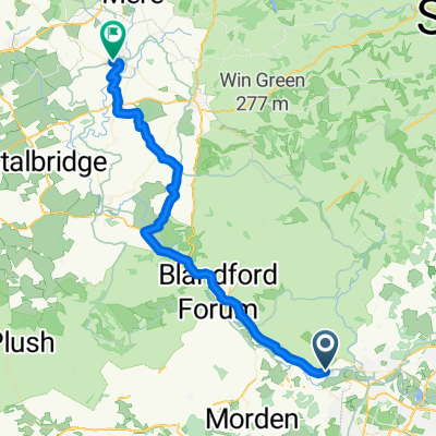 Gillingham via trailway 2nd part
- Distance
- 44.5 km
- Ascent
- 401 m
- Descent
- 332 m
- Location
- Wimborne Minster, England, United Kingdom
Open it in the app