

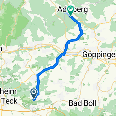
alb_50km
A cycling route starting in Ohmden, Baden-Wurttemberg, Germany.
Overview
About this route
- -:--
- Duration
- 47.1 km
- Distance
- 898 m
- Ascent
- 886 m
- Descent
- ---
- Avg. speed
- 754 m
- Max. altitude
Route quality
Waytypes & surfaces along the route
Waytypes
Road
13.2 km
(28 %)
Track
3.3 km
(7 %)
Surfaces
Paved
37.7 km
(80 %)
Unpaved
0.5 km
(1 %)
Asphalt
37.2 km
(79 %)
Paved (undefined)
0.5 km
(1 %)
Continue with Bikemap
Use, edit, or download this cycling route
You would like to ride alb_50km or customize it for your own trip? Here is what you can do with this Bikemap route:
Free features
- Save this route as favorite or in collections
- Copy & plan your own version of this route
- Sync your route with Garmin or Wahoo
Premium features
Free trial for 3 days, or one-time payment. More about Bikemap Premium.
- Navigate this route on iOS & Android
- Export a GPX / KML file of this route
- Create your custom printout (try it for free)
- Download this route for offline navigation
Discover more Premium features.
Get Bikemap PremiumFrom our community
Other popular routes starting in Ohmden
 Wendlingen-Dettenhausen
- Distance
- 89.8 km
- Ascent
- 350 m
- Descent
- 350 m
- Location
- Ohmden, Baden-Wurttemberg, Germany
 alb_50km
- Distance
- 47.1 km
- Ascent
- 898 m
- Descent
- 886 m
- Location
- Ohmden, Baden-Wurttemberg, Germany
 Herrenmühle Adelberg
- Distance
- 18.2 km
- Ascent
- 282 m
- Descent
- 259 m
- Location
- Ohmden, Baden-Wurttemberg, Germany
 Fam Reichert Rundweg
- Distance
- 22.7 km
- Ascent
- 115 m
- Descent
- 206 m
- Location
- Ohmden, Baden-Wurttemberg, Germany
 Ohmden - Hepsisau - Neidlingen
- Distance
- 38.7 km
- Ascent
- 586 m
- Descent
- 586 m
- Location
- Ohmden, Baden-Wurttemberg, Germany
 Stahlackerweg 64, Ohmden nach Stahlackerweg 23, Ohmden
- Distance
- 15.4 km
- Ascent
- 203 m
- Descent
- 203 m
- Location
- Ohmden, Baden-Wurttemberg, Germany
 Zeller Straße 3, Ohmden naar Mühlgraben 26, Ellwangen (Jagst)
- Distance
- 71.5 km
- Ascent
- 1,005 m
- Descent
- 951 m
- Location
- Ohmden, Baden-Wurttemberg, Germany
 Schlierbach-Birkenhof-Roßteich-Sparwiesen-Hattenhofen
- Distance
- 22.9 km
- Ascent
- 261 m
- Descent
- 259 m
- Location
- Ohmden, Baden-Wurttemberg, Germany
Open it in the app