work commute
- 24.5 km
- 487 m
- 475 m
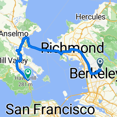
- Berkeley, California, United States
A cycling route starting in Berkeley, California, United States.
Overview
Hilly ride, 2-2:30 hrs, an east bay favorite
created this 16 years ago
Route quality
Road
40.8 km
(70 %)
Quiet road
1.2 km
(2 %)
Undefined
16.3 km
(28 %)
Paved
32.1 km
(55 %)
Asphalt
28.6 km
(49 %)
Paved (undefined)
3.5 km
(6 %)
Undefined
26.3 km
(45 %)
Continue with Bikemap
You would like to ride Three Bears or customize it for your own trip? Here is what you can do with this Bikemap route:
Free trial for 3 days, or one-time payment. More about Bikemap Premium.
Discover more Premium features.
Get Bikemap PremiumFrom our community
Open it in the app