

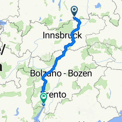
2014_1_Großglockner-Runde_Tegernsee/Kreuth - Scheffau a. Wilden Kaiser
A cycling route starting in Kreuth, Bavaria, Germany.
Overview
About this route
Kreuth - Valepp - Spitzing See - Bayrischzell - Kufstein - Scheffau
- -:--
- Duration
- 86.8 km
- Distance
- 1,006 m
- Ascent
- 1,133 m
- Descent
- ---
- Avg. speed
- ---
- Max. altitude

Route quality
Waytypes & surfaces along the route
Waytypes
Busy road
58 km
(67 %)
Quiet road
16.4 km
(19 %)
Surfaces
Paved
84.6 km
(97 %)
Unpaved
0.1 km
(<1 %)
Asphalt
83.8 km
(96 %)
Paved (undefined)
0.8 km
(<1 %)
Continue with Bikemap
Use, edit, or download this cycling route
You would like to ride 2014_1_Großglockner-Runde_Tegernsee/Kreuth - Scheffau a. Wilden Kaiser or customize it for your own trip? Here is what you can do with this Bikemap route:
Free features
- Save this route as favorite or in collections
- Copy & plan your own version of this route
- Split it into stages to create a multi-day tour
- Sync your route with Garmin or Wahoo
Premium features
Free trial for 3 days, or one-time payment. More about Bikemap Premium.
- Navigate this route on iOS & Android
- Export a GPX / KML file of this route
- Create your custom printout (try it for free)
- Download this route for offline navigation
Discover more Premium features.
Get Bikemap PremiumFrom our community
Other popular routes starting in Kreuth
 Transalp Tegernsee - Gardasee
- Distance
- 350.6 km
- Ascent
- 7,673 m
- Descent
- 8,380 m
- Location
- Kreuth, Bavaria, Germany
 Schinder Umrundung kurz
- Distance
- 45.6 km
- Ascent
- 1,352 m
- Descent
- 1,352 m
- Location
- Kreuth, Bavaria, Germany
 Roehrloosalm_Lenggries
- Distance
- 9 km
- Ascent
- 115 m
- Descent
- 513 m
- Location
- Kreuth, Bavaria, Germany
 Ausfahrt von Kreuth nach Tegernsee
- Distance
- 26.1 km
- Ascent
- 107 m
- Descent
- 216 m
- Location
- Kreuth, Bavaria, Germany
 Achensee und Inntal
- Distance
- 92.8 km
- Ascent
- 542 m
- Descent
- 803 m
- Location
- Kreuth, Bavaria, Germany
 Transalp Tegernsee - Gardasee
- Distance
- 350.6 km
- Ascent
- 7,795 m
- Descent
- 8,502 m
- Location
- Kreuth, Bavaria, Germany
 Kreuth, Bauer in der Au, Schwaruentenn, Königsalm
- Distance
- 28.1 km
- Ascent
- 455 m
- Descent
- 429 m
- Location
- Kreuth, Bavaria, Germany
 Gufferthütte bis Achenkirchen
- Distance
- 15.8 km
- Ascent
- 447 m
- Descent
- 986 m
- Location
- Kreuth, Bavaria, Germany
Open it in the app