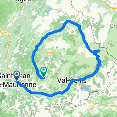
Col d'Albanne and Les Karellis
A cycling route starting in Villargondran, Auvergne-Rh么ne-Alpes, France.
Overview
About this route
Great climb in the mountains beside Col du Galibier
- -:--
- Duration
- 45.2 km
- Distance
- 1,379 m
- Ascent
- 1,391 m
- Descent
- ---
- Avg. speed
- ---
- Max. altitude
Route quality
Waytypes & surfaces along the route
Waytypes
Road
13.1 km
(29 %)
Quiet road
8.6 km
(19 %)
Surfaces
Paved
25.3 km
(56 %)
Unpaved
1.4 km
(3 %)
Asphalt
25.3 km
(56 %)
Ground
0.9 km
(2 %)
Route highlights
Points of interest along the route
Point of interest after 16.5 km
Les Karellis
Point of interest after 20.3 km
Col d'Albanne
Point of interest after 25 km
Fort and Col du T茅l茅graphe
Continue with Bikemap
Use, edit, or download this cycling route
You would like to ride Col d'Albanne and Les Karellis or customize it for your own trip? Here is what you can do with this Bikemap route:
Free features
- Save this route as favorite or in collections
- Copy & plan your own version of this route
- Sync your route with Garmin or Wahoo
Premium features
Free trial for 3 days, or one-time payment. More about Bikemap Premium.
- Navigate this route on iOS & Android
- Export a GPX / KML file of this route
- Create your custom printout (try it for free)
- Download this route for offline navigation
Discover more Premium features.
Get Bikemap PremiumFrom our community
Other popular routes starting in Villargondran
- Saint Jean de Maurienne Rochilles Parpaillon
- Distance
- 465.3 km
- Ascent
- 7,303 m
- Descent
- 7,716 m
- Location
- Villargondran, Auvergne-Rh么ne-Alpes, France
- Col du Galibier via Albanne
- Distance
- 91.5 km
- Ascent
- 2,534 m
- Descent
- 2,534 m
- Location
- Villargondran, Auvergne-Rh么ne-Alpes, France
- Col de la Croix de Fer and Col du Glandon
- Distance
- 65.6 km
- Ascent
- 1,676 m
- Descent
- 1,676 m
- Location
- Villargondran, Auvergne-Rh么ne-Alpes, France
- Col de la Croix de Fer and La Toussuire
- Distance
- 85.8 km
- Ascent
- 2,510 m
- Descent
- 2,510 m
- Location
- Villargondran, Auvergne-Rh么ne-Alpes, France
- Alpes IV
- Distance
- 104.3 km
- Ascent
- 2,842 m
- Descent
- 2,841 m
- Location
- Villargondran, Auvergne-Rh么ne-Alpes, France
- Monvernier - Col de la Madeleine - 2
- Distance
- 81.2 km
- Ascent
- 3,156 m
- Descent
- 3,158 m
- Location
- Villargondran, Auvergne-Rh么ne-Alpes, France
- ClimbingChallenge2019
- Distance
- 111.1 km
- Ascent
- 3,141 m
- Descent
- 3,140 m
- Location
- Villargondran, Auvergne-Rh么ne-Alpes, France
- Col du Galibier et Col de la Croix de Fer
- Distance
- 163.9 km
- Ascent
- 3,514 m
- Descent
- 3,511 m
- Location
- Villargondran, Auvergne-Rh么ne-Alpes, France
Open it in the app