

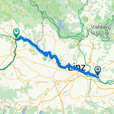
MTB Runde 29km - Schwertberg -Weinzierl - Lanzenberg - Judenleiten - Oberlebing - Lina - Schedlberg - Windegg - Josefstal - Hartl - Doppl - Schwertberg
A cycling route starting in Perg, Upper Austria, Austria.
Overview
About this route
Die Strecke führt Trails, Wiesen, Gütterwege nach Weinzierl bzw. Lanzenberg. Auf Güterwegen und Forstwegen führt die Route bis Oberlebing und weiter nach Lina zum Weltstein. Ein kurzer Downhill in den Schacher folgt. Über Schedlberg führt die Runde zur Ruine Windegg. Die Aistleide runter gelangt man ins Josefstal. Die Aist wird überquert und bei der Kurve führt die Strecke aufwärts bis Hartl. Ab jetzt geht es nur noch abwärts zum Eisernen Gitter.
Angaben zur Route (1 = leicht, 10 = schwer) Kondition: 6 Technik: 5 Abwechslung: 7 st- -:--
- Duration
- 28.2 km
- Distance
- 639 m
- Ascent
- 641 m
- Descent
- ---
- Avg. speed
- ---
- Avg. speed
Route quality
Waytypes & surfaces along the route
Waytypes
Quiet road
10.6 km
(38 %)
Track
9 km
(32 %)
Surfaces
Paved
0 km
(<1 %)
Unpaved
3.7 km
(13 %)
Ground
2.4 km
(9 %)
Unpaved (undefined)
1.3 km
(5 %)
Continue with Bikemap
Use, edit, or download this cycling route
You would like to ride MTB Runde 29km - Schwertberg -Weinzierl - Lanzenberg - Judenleiten - Oberlebing - Lina - Schedlberg - Windegg - Josefstal - Hartl - Doppl - Schwertberg or customize it for your own trip? Here is what you can do with this Bikemap route:
Free features
- Save this route as favorite or in collections
- Copy & plan your own version of this route
- Sync your route with Garmin or Wahoo
Premium features
Free trial for 3 days, or one-time payment. More about Bikemap Premium.
- Navigate this route on iOS & Android
- Export a GPX / KML file of this route
- Create your custom printout (try it for free)
- Download this route for offline navigation
Discover more Premium features.
Get Bikemap PremiumFrom our community
Other popular routes starting in Perg
 Birkenweg 19, Tragwein nach Lärchenweg 28, Tragwein
- Distance
- 14.5 km
- Ascent
- 205 m
- Descent
- 207 m
- Location
- Perg, Upper Austria, Austria
 Flößerweg, Naarn im Machlande nach Kreuznerstraße, Grein
- Distance
- 32.2 km
- Ascent
- 239 m
- Descent
- 222 m
- Location
- Perg, Upper Austria, Austria
 Perg - St.Thomas - Rechberg - PErg
- Distance
- 45.4 km
- Ascent
- 878 m
- Descent
- 878 m
- Location
- Perg, Upper Austria, Austria
 11. Naarn im Machlande-Engelhartszell
- Distance
- 100.2 km
- Ascent
- 1,243 m
- Descent
- 1,185 m
- Location
- Perg, Upper Austria, Austria
 Au - Pasau Donauradweg
- Distance
- 125.4 km
- Ascent
- 363 m
- Descent
- 297 m
- Location
- Perg, Upper Austria, Austria
 Wien Passau-Etappe 3
- Distance
- 125.5 km
- Ascent
- 1,552 m
- Descent
- 1,486 m
- Location
- Perg, Upper Austria, Austria
 schwert-lina-windegg-schwert
- Distance
- 14.8 km
- Ascent
- 355 m
- Descent
- 357 m
- Location
- Perg, Upper Austria, Austria
 Prandegg Runde
- Distance
- 23.3 km
- Ascent
- 521 m
- Descent
- 522 m
- Location
- Perg, Upper Austria, Austria
Open it in the app