

B14-Wald-Gibswil-Bauma-Wetzikon-Hinwil-B14
A cycling route starting in Rapperswil, Canton of St. Gallen, Switzerland.
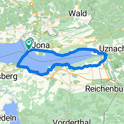
Overview
About this route
Tobik in the stroller
- -:--
- Duration
- 51.5 km
- Distance
- 490 m
- Ascent
- 489 m
- Descent
- ---
- Avg. speed
- ---
- Max. altitude
Route quality
Waytypes & surfaces along the route
Waytypes
Path
13.4 km
(26 %)
Road
11.3 km
(22 %)
Surfaces
Paved
50.4 km
(98 %)
Asphalt
50.4 km
(98 %)
Undefined
1 km
(2 %)
Continue with Bikemap
Use, edit, or download this cycling route
You would like to ride B14-Wald-Gibswil-Bauma-Wetzikon-Hinwil-B14 or customize it for your own trip? Here is what you can do with this Bikemap route:
Free features
- Save this route as favorite or in collections
- Copy & plan your own version of this route
- Sync your route with Garmin or Wahoo
Premium features
Free trial for 3 days, or one-time payment. More about Bikemap Premium.
- Navigate this route on iOS & Android
- Export a GPX / KML file of this route
- Create your custom printout (try it for free)
- Download this route for offline navigation
Discover more Premium features.
Get Bikemap PremiumFrom our community
Other popular routes starting in Rapperswil
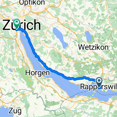 From Rapperswil-Jona to Zurich
- Distance
- 35.6 km
- Ascent
- 364 m
- Descent
- 350 m
- Location
- Rapperswil, Canton of St. Gallen, Switzerland
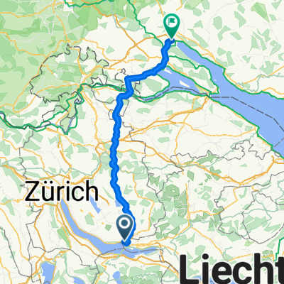 Zürich (Kreis 1) / Lindenhof - Bodman-Ludwigshafen
- Distance
- 92.6 km
- Ascent
- 1,065 m
- Descent
- 1,086 m
- Location
- Rapperswil, Canton of St. Gallen, Switzerland
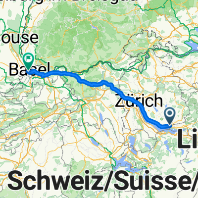 Rapperswil SG - Stein
- Distance
- 123.5 km
- Ascent
- 970 m
- Descent
- 1,119 m
- Location
- Rapperswil, Canton of St. Gallen, Switzerland
 70.3 Švicar
- Distance
- 42.8 km
- Ascent
- 467 m
- Descent
- 467 m
- Location
- Rapperswil, Canton of St. Gallen, Switzerland
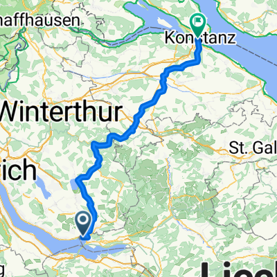 Rapperswil SG - Kreuzlingen
- Distance
- 79.8 km
- Ascent
- 915 m
- Descent
- 938 m
- Location
- Rapperswil, Canton of St. Gallen, Switzerland
 Sattelegg - Ibergeregg - Zugersee
- Distance
- 117.9 km
- Ascent
- 1,857 m
- Descent
- 1,858 m
- Location
- Rapperswil, Canton of St. Gallen, Switzerland
 Rapperswil - Forch - Eigental - Irchel - Rumstal - Seegräben - Rapperswil
- Distance
- 120.1 km
- Ascent
- 944 m
- Descent
- 942 m
- Location
- Rapperswil, Canton of St. Gallen, Switzerland
 Rundtour Rapperswil
- Distance
- 35 km
- Ascent
- 182 m
- Descent
- 184 m
- Location
- Rapperswil, Canton of St. Gallen, Switzerland
Open it in the app