

Festung Immendorf, Golfplatz, TÜP, Festung
A cycling route starting in Urbar, Rhineland-Palatinate, Germany.
Overview
About this route
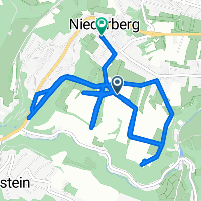
Start at the fortress, passing by the old barracks towards Urbar. Shortly after, turn right onto the dirt path and keep right. Now you come to the first small highlight, stairs and a short trail section up to a bridge. Continue towards Immendorf. There, go down to the sign for the barbecue hut, once you arrive at the bottom, stay left, follow the path until you reach a narrow bridge or ride through the water. If you choose the water crossing, you can glimpse a trail that you can ride at your leisure, or alternatively the wider forest path. Now relax for a bit for a steep serpentine climb. The turns are tight and occasionally steep. Upon reaching the top, head towards Simmern, but first, go back into the forest and down to another barbecue hut, there you turn left. After a while the path forks into 2-5 paths, keep to the right. At this fork, look out for the trail rising to the left. This path should take you to a main road that you need to cross. After that, just continue leisurely past the golf course and through the troop training area. Now it will only be a bit undulating and easy to ride.
- -:--
- Duration
- 30.5 km
- Distance
- 454 m
- Ascent
- 452 m
- Descent
- ---
- Avg. speed
- ---
- Max. altitude

Route highlights
Points of interest along the route
Point of interest after 2.6 km
Trail mit Treppen kurz aber schön
Point of interest after 8 km
Trail hoch
Point of interest after 13 km
Trail links oberhalb der Strecke
Continue with Bikemap
Use, edit, or download this cycling route
You would like to ride Festung Immendorf, Golfplatz, TÜP, Festung or customize it for your own trip? Here is what you can do with this Bikemap route:
Free features
- Save this route as favorite or in collections
- Copy & plan your own version of this route
- Sync your route with Garmin or Wahoo
Premium features
Free trial for 3 days, or one-time payment. More about Bikemap Premium.
- Navigate this route on iOS & Android
- Export a GPX / KML file of this route
- Create your custom printout (try it for free)
- Download this route for offline navigation
Discover more Premium features.
Get Bikemap PremiumFrom our community
Other popular routes starting in Urbar
 Festung Immendorf, Golfplatz, TÜP, Festung
- Distance
- 30.5 km
- Ascent
- 454 m
- Descent
- 452 m
- Location
- Urbar, Rhineland-Palatinate, Germany
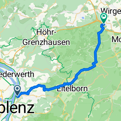
 Tour kannenbäckerland
- Distance
- 46.6 km
- Ascent
- 492 m
- Descent
- 518 m
- Location
- Urbar, Rhineland-Palatinate, Germany
 Über den Köppel
- Distance
- 61.3 km
- Ascent
- 870 m
- Descent
- 977 m
- Location
- Urbar, Rhineland-Palatinate, Germany
 7-Brücken-Runde Teil 2 19 km
- Distance
- 17.1 km
- Ascent
- 71 m
- Descent
- 184 m
- Location
- Urbar, Rhineland-Palatinate, Germany
 Skattour mosel rhein
- Distance
- 141.2 km
- Ascent
- 783 m
- Descent
- 767 m
- Location
- Urbar, Rhineland-Palatinate, Germany
 Koblenz-Köln
- Distance
- 98.8 km
- Ascent
- 68 m
- Descent
- 75 m
- Location
- Urbar, Rhineland-Palatinate, Germany
 Im Weeling, Koblenz nach Arenberger Straße, Koblenz
- Distance
- 12.3 km
- Ascent
- 309 m
- Descent
- 336 m
- Location
- Urbar, Rhineland-Palatinate, Germany
 Seilbahn Koblenz nach Schöne Aussicht
- Distance
- 20.8 km
- Ascent
- 518 m
- Descent
- 388 m
- Location
- Urbar, Rhineland-Palatinate, Germany
Open it in the app