
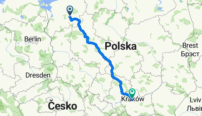
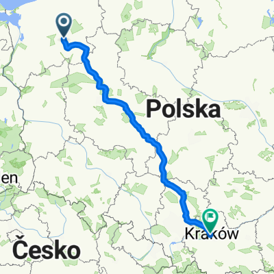
MT Rally 2
A cycling route starting in Drawsko Pomorskie, West Pomeranian Voivodeship, Poland.
Overview
About this route
600 km z północy na południe
- -:--
- Duration
- 582.7 km
- Distance
- 753 m
- Ascent
- 643 m
- Descent
- ---
- Avg. speed
- ---
- Max. altitude
Route quality
Waytypes & surfaces along the route
Waytypes
Busy road
272.4 km
(47 %)
Quiet road
83.2 km
(14 %)
Surfaces
Paved
413.4 km
(71 %)
Unpaved
20.1 km
(3 %)
Asphalt
372 km
(64 %)
Paving stones
28.8 km
(5 %)
Continue with Bikemap
Use, edit, or download this cycling route
You would like to ride MT Rally 2 or customize it for your own trip? Here is what you can do with this Bikemap route:
Free features
- Save this route as favorite or in collections
- Copy & plan your own version of this route
- Split it into stages to create a multi-day tour
- Sync your route with Garmin or Wahoo
Premium features
Free trial for 3 days, or one-time payment. More about Bikemap Premium.
- Navigate this route on iOS & Android
- Export a GPX / KML file of this route
- Create your custom printout (try it for free)
- Download this route for offline navigation
Discover more Premium features.
Get Bikemap PremiumFrom our community
Other popular routes starting in Drawsko Pomorskie
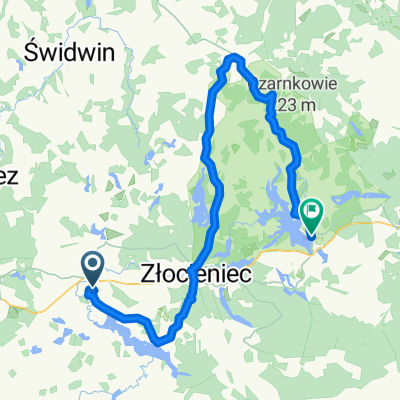
 Wzgórza Moreny Czołowej (niebieski)
- Distance
- 54.3 km
- Ascent
- 235 m
- Descent
- 235 m
- Location
- Drawsko Pomorskie, West Pomeranian Voivodeship, Poland
 VVG Drawskie
- Distance
- 156.3 km
- Ascent
- 313 m
- Descent
- 280 m
- Location
- Drawsko Pomorskie, West Pomeranian Voivodeship, Poland
 MT Rally 2
- Distance
- 582.7 km
- Ascent
- 753 m
- Descent
- 643 m
- Location
- Drawsko Pomorskie, West Pomeranian Voivodeship, Poland
 🇵🇱 Drawsko Pom. - Szczecin (139km)
- Distance
- 234.5 km
- Ascent
- 941 m
- Descent
- 941 m
- Location
- Drawsko Pomorskie, West Pomeranian Voivodeship, Poland
 dzien trzeci
- Distance
- 86.9 km
- Ascent
- 336 m
- Descent
- 327 m
- Location
- Drawsko Pomorskie, West Pomeranian Voivodeship, Poland
 Brzeźnicka Węgorza Wodospady
- Distance
- 36.1 km
- Ascent
- 205 m
- Descent
- 206 m
- Location
- Drawsko Pomorskie, West Pomeranian Voivodeship, Poland
 Czerwony Szlak - Jezioro Lubie
- Distance
- 47.2 km
- Ascent
- 423 m
- Descent
- 424 m
- Location
- Drawsko Pomorskie, West Pomeranian Voivodeship, Poland
 Drawsko "Wzgórza Moreny Czołowej" - Niebieski
- Distance
- 56.1 km
- Ascent
- 196 m
- Descent
- 196 m
- Location
- Drawsko Pomorskie, West Pomeranian Voivodeship, Poland
Open it in the app