

Igal-S.aszaló-Deseda-Toponár-Igal (44,63 km)
A cycling route starting in Taszár, Somogy County, Hungary.
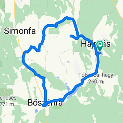
Overview
About this route
Részben azfaltozott, részben földút, egy kis terep az erdőben és kiépített kerékpárút. Ez jellemzi a Deseda kör kissé izgalmasabb útvonalát, amit szinte bátmilyen kerékpárral lehet teljesíteni és egyáltalán nem igényel különösebb erőnlétet.
A tó látványa minden évszakban lenyűgöző, ha +1 órát és 3 km-t rászánunk, érdemes megnézni az arborétumot is! - -:--
- Duration
- 44.7 km
- Distance
- 300 m
- Ascent
- 300 m
- Descent
- ---
- Avg. speed
- ---
- Max. altitude

Route quality
Waytypes & surfaces along the route
Waytypes
Track
6.3 km
(14 %)
Quiet road
5.8 km
(13 %)
Surfaces
Paved
28.6 km
(64 %)
Unpaved
4.9 km
(11 %)
Asphalt
28.1 km
(63 %)
Ground
3.1 km
(7 %)
Route highlights
Points of interest along the route
Point of interest after 24.9 km
Deseda Büfésor - Strand
Continue with Bikemap
Use, edit, or download this cycling route
You would like to ride Igal-S.aszaló-Deseda-Toponár-Igal (44,63 km) or customize it for your own trip? Here is what you can do with this Bikemap route:
Free features
- Save this route as favorite or in collections
- Copy & plan your own version of this route
- Sync your route with Garmin or Wahoo
Premium features
Free trial for 3 days, or one-time payment. More about Bikemap Premium.
- Navigate this route on iOS & Android
- Export a GPX / KML file of this route
- Create your custom printout (try it for free)
- Download this route for offline navigation
Discover more Premium features.
Get Bikemap PremiumFrom our community
Other popular routes starting in Taszár
 Várong, kaktuszfarm
- Distance
- 11.1 km
- Ascent
- 112 m
- Descent
- 120 m
- Location
- Taszár, Somogy County, Hungary
 DDK Mecseki Kék 1
- Distance
- 16.9 km
- Ascent
- 270 m
- Descent
- 270 m
- Location
- Taszár, Somogy County, Hungary
 Igal - Gölle kör
- Distance
- 38.3 km
- Ascent
- 206 m
- Descent
- 204 m
- Location
- Taszár, Somogy County, Hungary
 Tavaszi bemelegítés Igal-Mernye-Igal
- Distance
- 12.5 km
- Ascent
- 142 m
- Descent
- 163 m
- Location
- Taszár, Somogy County, Hungary
 Hajmás - Hajmás
- Distance
- 26.4 km
- Ascent
- 268 m
- Descent
- 272 m
- Location
- Taszár, Somogy County, Hungary
 up ob
up ob- Distance
- 61.3 km
- Ascent
- 553 m
- Descent
- 574 m
- Location
- Taszár, Somogy County, Hungary
 fonó,homok,mosdós
- Distance
- 21.9 km
- Ascent
- 121 m
- Descent
- 119 m
- Location
- Taszár, Somogy County, Hungary
 Igal-Deseda-2
- Distance
- 54.6 km
- Ascent
- 314 m
- Descent
- 314 m
- Location
- Taszár, Somogy County, Hungary
Open it in the app