Dörrenbach
- 45.9 km
- 345 m
- 345 m
- Kandel, Rhineland-Palatinate, Germany
A cycling route starting in Kandel, Rhineland-Palatinate, Germany.
Overview
76870-Kandel Industriestrasse B 49.09970 L 8.18343
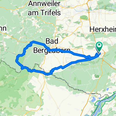
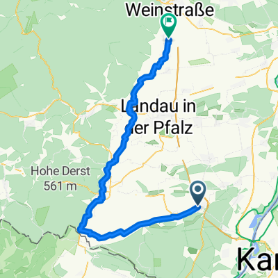
From Hochstrasse to Eusertal Starting in Kandel heading north to Erlenbach, Hayna, Herxheim, Bornheim (rural area), then northwest to Nussdorf, Böchingen, Gleisweiler, Burrweiler (wine region), continuing into the Modenbachtal valley and up to the Forsthaus Heldenstein, then straight on into the Hochstrasse (unpaved road). On Hochstrasse we ride about 2 km until a small wooden sign on the left points down to Walsheimer Hütte. Follow the gravel path in switchbacks (Katzenbach and Birkental towards the village of Eusertal). At the northern edge of the village, behind the sports field, fresh trout are available (closed Monday and Tuesday). Return to Kandel via Albersweiler, Siebeldingen, Arzheim, Ilbesheim, Mörzheim, Impflingen, Rohrbach, and Steinweiler.
created this 11 years ago
Route quality
Track
27.8 km
(36 %)
Quiet road
16.2 km
(21 %)
Paved
62.6 km
(81 %)
Unpaved
10 km
(13 %)
Asphalt
56.4 km
(73 %)
Gravel
7.7 km
(10 %)
Continue with Bikemap
You would like to ride Walsheimer Hütte or customize it for your own trip? Here is what you can do with this Bikemap route:
Free trial for 3 days, or one-time payment. More about Bikemap Premium.
Discover more Premium features.
Get Bikemap PremiumFrom our community
Open it in the app