

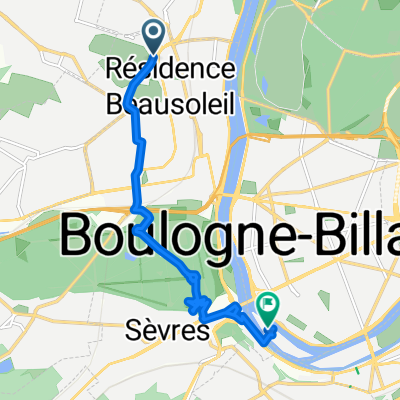
St Cloud Bagneux au plus court
A cycling route starting in Saint-Cloud, Île-de-France Region, France.
Overview
About this route
St Cloud & Bagneux by the shortest route
- -:--
- Duration
- 14.3 km
- Distance
- 126 m
- Ascent
- 151 m
- Descent
- ---
- Avg. speed
- ---
- Max. altitude
Route quality
Waytypes & surfaces along the route
Waytypes
Quiet road
1.9 km
(13 %)
Road
1.6 km
(11 %)
Surfaces
Paved
12.9 km
(90 %)
Asphalt
12.9 km
(90 %)
Undefined
1.4 km
(10 %)
Continue with Bikemap
Use, edit, or download this cycling route
You would like to ride St Cloud Bagneux au plus court or customize it for your own trip? Here is what you can do with this Bikemap route:
Free features
- Save this route as favorite or in collections
- Copy & plan your own version of this route
- Sync your route with Garmin or Wahoo
Premium features
Free trial for 3 days, or one-time payment. More about Bikemap Premium.
- Navigate this route on iOS & Android
- Export a GPX / KML file of this route
- Create your custom printout (try it for free)
- Download this route for offline navigation
Discover more Premium features.
Get Bikemap PremiumFrom our community
Other popular routes starting in Saint-Cloud
 Autour du château de Versailles
- Distance
- 45.7 km
- Ascent
- 634 m
- Descent
- 634 m
- Location
- Saint-Cloud, Île-de-France Region, France
 Vallée de chevreuse
- Distance
- 76.9 km
- Ascent
- 668 m
- Descent
- 661 m
- Location
- Saint-Cloud, Île-de-France Region, France
 Paris x Reims x Paris
- Distance
- 412 km
- Ascent
- 1,148 m
- Descent
- 1,147 m
- Location
- Saint-Cloud, Île-de-France Region, France
 Saint cloud>> les petites dalles
- Distance
- 190.4 km
- Ascent
- 720 m
- Descent
- 803 m
- Location
- Saint-Cloud, Île-de-France Region, France
 PSC-TST-001
- Distance
- 163.5 km
- Ascent
- 558 m
- Descent
- 556 m
- Location
- Saint-Cloud, Île-de-France Region, France
 Rock En Seine
- Distance
- 16.4 km
- Ascent
- 187 m
- Descent
- 108 m
- Location
- Saint-Cloud, Île-de-France Region, France
 Tout droit à l'intérieur Boulogne-Billancourt
- Distance
- 8.4 km
- Ascent
- 93 m
- Descent
- 152 m
- Location
- Saint-Cloud, Île-de-France Region, France
 Relaxed route in Paris
- Distance
- 14.3 km
- Ascent
- 119 m
- Descent
- 157 m
- Location
- Saint-Cloud, Île-de-France Region, France
Open it in the app