

San Roque to Gibraltar (La Linea de la Concepcion)
A cycling route starting in San Roque, Andalusia, Spain.
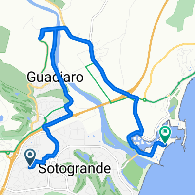
Overview
About this route
Route 3, Part 2 - this is the second part of the journey from Zahara de los Atunes to Gibraltar (La Linea de la Concepcion). We suggest catching the train from Algeciras to San Roque-La Línea as the N340 after Algeciras is very busy and dangerous. When you get off the train at San Roque-La Línea, the ride to Gibraltar is quiet and flat.
This route is part of the handbook Mediterranean Spain by Bicycle- -:--
- Duration
- 12.5 km
- Distance
- 63 m
- Ascent
- 60 m
- Descent
- ---
- Avg. speed
- ---
- Max. altitude

Route quality
Waytypes & surfaces along the route
Waytypes
Busy road
4.5 km
(36 %)
Cycleway
3.6 km
(29 %)
Surfaces
Paved
10.1 km
(80 %)
Unpaved
0.1 km
(<1 %)
Asphalt
9.7 km
(77 %)
Paved (undefined)
0.2 km
(2 %)
Continue with Bikemap
Use, edit, or download this cycling route
You would like to ride San Roque to Gibraltar (La Linea de la Concepcion) or customize it for your own trip? Here is what you can do with this Bikemap route:
Free features
- Save this route as favorite or in collections
- Copy & plan your own version of this route
- Sync your route with Garmin or Wahoo
Premium features
Free trial for 3 days, or one-time payment. More about Bikemap Premium.
- Navigate this route on iOS & Android
- Export a GPX / KML file of this route
- Create your custom printout (try it for free)
- Download this route for offline navigation
Discover more Premium features.
Get Bikemap PremiumFrom our community
Other popular routes starting in San Roque
 De Avenida de Arenillas, 4, San Roque a Plaza de la Reconquista, 8, Almería
- Distance
- 395.5 km
- Ascent
- 101 m
- Descent
- 58 m
- Location
- San Roque, Andalusia, Spain
 Gelida-La Creu
- Distance
- 1,178.7 km
- Ascent
- 4,614 m
- Descent
- 4,126 m
- Location
- San Roque, Andalusia, Spain
 20-01-06 La Línea de la concepción
- Distance
- 18 km
- Ascent
- 23 m
- Descent
- 108 m
- Location
- San Roque, Andalusia, Spain
 8. Taraguilla - Tarifa - Conil de la Frontera
- Distance
- 116.8 km
- Ascent
- 879 m
- Descent
- 848 m
- Location
- San Roque, Andalusia, Spain
 Sotogrande-Pinar del Rey
- Distance
- 37.7 km
- Ascent
- 439 m
- Descent
- 436 m
- Location
- San Roque, Andalusia, Spain
 Sotogrande San Martin del Tesorillo, San Pablo de Buceite Jimena Sotogrande via Soto Alta
- Distance
- 66.3 km
- Ascent
- 334 m
- Descent
- 342 m
- Location
- San Roque, Andalusia, Spain
 15.10 Gibr
- Distance
- 17.1 km
- Ascent
- 144 m
- Descent
- 203 m
- Location
- San Roque, Andalusia, Spain
 Recorded via Apple Watch - 31/07/2021, 19:17
- Distance
- 10.4 km
- Ascent
- 0 m
- Descent
- 0 m
- Location
- San Roque, Andalusia, Spain
Open it in the app