

Jarná rozcvička_2014_3
A cycling route starting in Komárom, Komárom-Esztergom, Hungary.
Overview
About this route
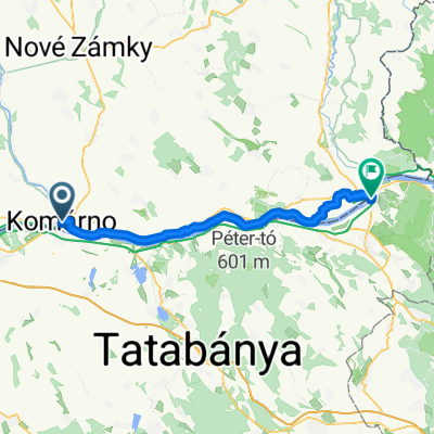
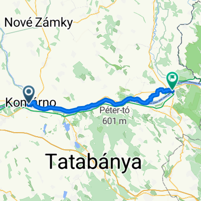
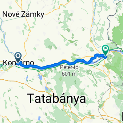
Komárno - Lándor - Martovce - Hliník - Kava - Lándor - Komárno
The route leads from Komárno to the Lándor area, from where it continues along the embankment beside the old Nitra riverbed to the village of Martovce, where it follows the Žitava riverbed (Žitava alluvium, floodplain forests). The route continues through the village of Martovce along a secondary class II road back to Komárno.
- -:--
- Duration
- 38.4 km
- Distance
- 34 m
- Ascent
- 35 m
- Descent
- ---
- Avg. speed
- ---
- Max. altitude

Route quality
Waytypes & surfaces along the route
Waytypes
Road
17.3 km
(45 %)
Quiet road
9.6 km
(25 %)
Surfaces
Paved
27.7 km
(72 %)
Unpaved
9.6 km
(25 %)
Asphalt
27.7 km
(72 %)
Ground
8.5 km
(22 %)
Route highlights
Points of interest along the route

Point of interest after 17.6 km
Alúvium Žitavy
Continue with Bikemap
Use, edit, or download this cycling route
You would like to ride Jarná rozcvička_2014_3 or customize it for your own trip? Here is what you can do with this Bikemap route:
Free features
- Save this route as favorite or in collections
- Copy & plan your own version of this route
- Sync your route with Garmin or Wahoo
Premium features
Free trial for 3 days, or one-time payment. More about Bikemap Premium.
- Navigate this route on iOS & Android
- Export a GPX / KML file of this route
- Create your custom printout (try it for free)
- Download this route for offline navigation
Discover more Premium features.
Get Bikemap PremiumFrom our community
Other popular routes starting in Komárom
 KN-Kopite-Gerecse-Tata-KN
- Distance
- 87.4 km
- Ascent
- 819 m
- Descent
- 818 m
- Location
- Komárom, Komárom-Esztergom, Hungary
 KN, Ács, Bábolna, Nagyigmánd, Kocs, Mocsa, KN
- Distance
- 70.5 km
- Ascent
- 128 m
- Descent
- 128 m
- Location
- Komárom, Komárom-Esztergom, Hungary
 Klapka György út - Báthori István utca
- Distance
- 47.7 km
- Ascent
- 88 m
- Descent
- 142 m
- Location
- Komárom, Komárom-Esztergom, Hungary
 Komárno - Štúrovo - Esztergom - Komárom
- Distance
- 114.5 km
- Ascent
- 58 m
- Descent
- 60 m
- Location
- Komárom, Komárom-Esztergom, Hungary
 Nádvorie Európy, Komárno to Széchenyi tér, Esztergom
- Distance
- 55.5 km
- Ascent
- 77 m
- Descent
- 80 m
- Location
- Komárom, Komárom-Esztergom, Hungary
 hotel peklo to hotel wellness
- Distance
- 56.2 km
- Ascent
- 76 m
- Descent
- 81 m
- Location
- Komárom, Komárom-Esztergom, Hungary
 Nám. gen. Klapku to Rákóczi tér
- Distance
- 58 km
- Ascent
- 80 m
- Descent
- 84 m
- Location
- Komárom, Komárom-Esztergom, Hungary
 Mérsékelt útvonal
- Distance
- 13.4 km
- Ascent
- 11 m
- Descent
- 3 m
- Location
- Komárom, Komárom-Esztergom, Hungary
Open it in the app