

Nottebianca ultratrail Montevecchia & San Genesio
A cycling route starting in Campofiorenzo-California, Lombardy, Italy.
Overview
About this route
<br type="_moz" /> <span style="display: none;"> </span>uyr <div id="cke_pastebin" style="left: -1000px; top: 25.79px; width: 1px; height: 1px; overflow: hidden; position: absolute;"> </div>
- -:--
- Duration
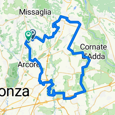
- 54.3 km
- Distance
- 884 m
- Ascent
- 884 m
- Descent
- ---
- Avg. speed
- ---
- Max. altitude
Route highlights
Points of interest along the route
Point of interest after 12.5 km
Punto Controllo
Point of interest after 21.1 km
Punto acqua non presidiato
Point of interest after 25.6 km
Punto Controllo
Point of interest after 25.7 km
Punto acqua presidiato
Point of interest after 35.5 km
Punto acqua non presidiato
Point of interest after 39.7 km
Punto acqua non presidiato
Continue with Bikemap
Use, edit, or download this cycling route
You would like to ride Nottebianca ultratrail Montevecchia & San Genesio or customize it for your own trip? Here is what you can do with this Bikemap route:
Free features
- Save this route as favorite or in collections
- Copy & plan your own version of this route
- Sync your route with Garmin or Wahoo
Premium features
Free trial for 3 days, or one-time payment. More about Bikemap Premium.
- Navigate this route on iOS & Android
- Export a GPX / KML file of this route
- Create your custom printout (try it for free)
- Download this route for offline navigation
Discover more Premium features.
Get Bikemap PremiumFrom our community
Other popular routes starting in Campofiorenzo-California
 Sanmauro T.A. 26/12 Trail Autogestisto
- Distance
- 34.5 km
- Ascent
- 327 m
- Descent
- 323 m
- Location
- Campofiorenzo-California, Lombardy, Italy
 Da Via San Giovanni Bosco 12/B, Campofiorenzo-California a Via alla Foppa 7, Dervio
- Distance
- 63 km
- Ascent
- 1,030 m
- Descent
- 1,077 m
- Location
- Campofiorenzo-California, Lombardy, Italy
 1^Montevecchia trail running
- Distance
- 36 km
- Ascent
- 458 m
- Descent
- 459 m
- Location
- Campofiorenzo-California, Lombardy, Italy
 Correzzana - Monticello - Besana - Triuggio
- Distance
- 29.9 km
- Ascent
- 316 m
- Descent
- 316 m
- Location
- Campofiorenzo-California, Lombardy, Italy
 2^ Montevecchia night trail
- Distance
- 34.6 km
- Ascent
- 353 m
- Descent
- 353 m
- Location
- Campofiorenzo-California, Lombardy, Italy
 Recording from 19:45 8 luglio
- Distance
- 26.8 km
- Ascent
- 157 m
- Descent
- 277 m
- Location
- Campofiorenzo-California, Lombardy, Italy
 a est di monza gf
- Distance
- 64.8 km
- Ascent
- 186 m
- Descent
- 190 m
- Location
- Campofiorenzo-California, Lombardy, Italy
 mtb drive experiences 4.12.2016
- Distance
- 33 km
- Ascent
- 341 m
- Descent
- 340 m
- Location
- Campofiorenzo-California, Lombardy, Italy
Open it in the app