

Lagg-FMO-Lagg
A cycling route starting in Ibbenbueren, North Rhine-Westphalia, Germany.
Overview
About this route
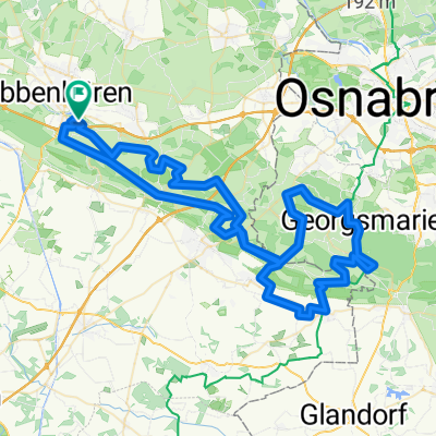
Nice evening ride of over 2 hours. At the beginning, it goes up to Tecklenburg, then it is flat until the end.
- -:--
- Duration
- 59.5 km
- Distance
- 227 m
- Ascent
- 228 m
- Descent
- ---
- Avg. speed
- ---
- Max. altitude

Route quality
Waytypes & surfaces along the route
Waytypes
Quiet road
20.8 km
(35 %)
Road
5.4 km
(9 %)
Surfaces
Paved
35.1 km
(59 %)
Asphalt
33.9 km
(57 %)
Paved (undefined)
1.2 km
(2 %)
Undefined
24.4 km
(41 %)
Continue with Bikemap
Use, edit, or download this cycling route
You would like to ride Lagg-FMO-Lagg or customize it for your own trip? Here is what you can do with this Bikemap route:
Free features
- Save this route as favorite or in collections
- Copy & plan your own version of this route
- Sync your route with Garmin or Wahoo
Premium features
Free trial for 3 days, or one-time payment. More about Bikemap Premium.
- Navigate this route on iOS & Android
- Export a GPX / KML file of this route
- Create your custom printout (try it for free)
- Download this route for offline navigation
Discover more Premium features.
Get Bikemap PremiumFrom our community
Other popular routes starting in Ibbenbueren
 Teutoburgerwaldtocht
- Distance
- 86.7 km
- Ascent
- 1,002 m
- Descent
- 941 m
- Location
- Ibbenbueren, North Rhine-Westphalia, Germany
 Tour nördl. Ibbenbüren
- Distance
- 50.5 km
- Ascent
- 156 m
- Descent
- 169 m
- Location
- Ibbenbueren, North Rhine-Westphalia, Germany
 Ausfahrt Marathon Ibbenbüren 25.07.2009
- Distance
- 56 km
- Ascent
- 302 m
- Descent
- 302 m
- Location
- Ibbenbueren, North Rhine-Westphalia, Germany
 Ibbenbüren 2019
- Distance
- 63.7 km
- Ascent
- 636 m
- Descent
- 635 m
- Location
- Ibbenbueren, North Rhine-Westphalia, Germany
 TECKELENBURG RONDE
- Distance
- 101.2 km
- Ascent
- 868 m
- Descent
- 867 m
- Location
- Ibbenbueren, North Rhine-Westphalia, Germany
 Dickenberg-Bramsche-Dickenberg
- Distance
- 66.7 km
- Ascent
- 163 m
- Descent
- 163 m
- Location
- Ibbenbueren, North Rhine-Westphalia, Germany
 Lagg-FMO-Lagg
- Distance
- 59.5 km
- Ascent
- 227 m
- Descent
- 228 m
- Location
- Ibbenbueren, North Rhine-Westphalia, Germany
 Teutoburgerwaldtocht 85km
- Distance
- 86.5 km
- Ascent
- 960 m
- Descent
- 922 m
- Location
- Ibbenbueren, North Rhine-Westphalia, Germany
Open it in the app