

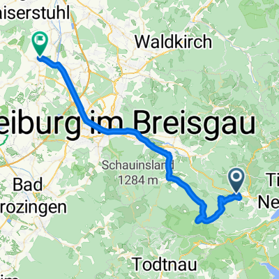
Tour de Sigi 2014
A cycling route starting in Breitnau, Baden-Württemberg, Germany.
Overview
About this route
Kandel - Feldberg - Wiedener Eck - Stohren - Zastler
- -:--
- Duration
- 199.1 km
- Distance
- 3,710 m
- Ascent
- 3,710 m
- Descent
- ---
- Avg. speed
- ---
- Max. altitude
Route quality
Waytypes & surfaces along the route
Waytypes
Busy road
84.2 km
(42 %)
Road
37.9 km
(19 %)
Surfaces
Paved
165.9 km
(83 %)
Unpaved
19.9 km
(10 %)
Asphalt
162.2 km
(81 %)
Ground
12.9 km
(6 %)
Continue with Bikemap
Use, edit, or download this cycling route
You would like to ride Tour de Sigi 2014 or customize it for your own trip? Here is what you can do with this Bikemap route:
Free features
- Save this route as favorite or in collections
- Copy & plan your own version of this route
- Split it into stages to create a multi-day tour
- Sync your route with Garmin or Wahoo
Premium features
Free trial for 3 days, or one-time payment. More about Bikemap Premium.
- Navigate this route on iOS & Android
- Export a GPX / KML file of this route
- Create your custom printout (try it for free)
- Download this route for offline navigation
Discover more Premium features.
Get Bikemap PremiumFrom our community
Other popular routes starting in Breitnau
 Tour de Sigi 2014
- Distance
- 199.1 km
- Ascent
- 3,710 m
- Descent
- 3,710 m
- Location
- Breitnau, Baden-Württemberg, Germany
 Die Abfahrt nach Frankreich
- Distance
- 57.4 km
- Ascent
- 161 m
- Descent
- 976 m
- Location
- Breitnau, Baden-Württemberg, Germany
 P(Hinterwaldkopf)-HöfenerHütte-P(Hinterwaldkopf)
- Distance
- 15.6 km
- Ascent
- 467 m
- Descent
- 467 m
- Location
- Breitnau, Baden-Württemberg, Germany
 Höllsteig 73, Breitnau nach Höllsteig 73, Breitnau
- Distance
- 56.9 km
- Ascent
- 755 m
- Descent
- 804 m
- Location
- Breitnau, Baden-Württemberg, Germany
 Breitnau - Kaiserstuhl
- Distance
- 46.4 km
- Ascent
- 492 m
- Descent
- 1,009 m
- Location
- Breitnau, Baden-Württemberg, Germany
 06_Breitnau-Gisiboden
- Distance
- 64.7 km
- Ascent
- 2,188 m
- Descent
- 2,047 m
- Location
- Breitnau, Baden-Württemberg, Germany
 Neustädter Höhenschlag
- Distance
- 68.3 km
- Ascent
- 1,053 m
- Descent
- 1,054 m
- Location
- Breitnau, Baden-Württemberg, Germany
 Breitnauer Sonnenrunde
- Distance
- 5.4 km
- Ascent
- 115 m
- Descent
- 115 m
- Location
- Breitnau, Baden-Württemberg, Germany
Open it in the app