

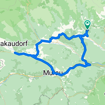
Sölkpaß-Hohentauern
A cycling route starting in Oberwölz Stadt, Styria, Austria.
Overview
About this route
- -:--
- Duration
- 183.5 km
- Distance
- 3,280 m
- Ascent
- 3,339 m
- Descent
- ---
- Avg. speed
- 1,800 m
- Max. altitude

Route quality
Waytypes & surfaces along the route
Waytypes
Quiet road
11 km
(6 %)
Path
5.5 km
(3 %)
Surfaces
Paved
155.9 km
(85 %)
Asphalt
155.9 km
(85 %)
Undefined
27.5 km
(15 %)
Continue with Bikemap
Use, edit, or download this cycling route
You would like to ride Sölkpaß-Hohentauern or customize it for your own trip? Here is what you can do with this Bikemap route:
Free features
- Save this route as favorite or in collections
- Copy & plan your own version of this route
- Split it into stages to create a multi-day tour
- Sync your route with Garmin or Wahoo
Premium features
Free trial for 3 days, or one-time payment. More about Bikemap Premium.
- Navigate this route on iOS & Android
- Export a GPX / KML file of this route
- Create your custom printout (try it for free)
- Download this route for offline navigation
Discover more Premium features.
Get Bikemap PremiumFrom our community
Other popular routes starting in Oberwölz Stadt
 Salchau nach Salchau
- Distance
- 70.4 km
- Ascent
- 1,636 m
- Descent
- 1,208 m
- Location
- Oberwölz Stadt, Styria, Austria
 Oberwölzer Radrennen CLONED FROM ROUTE 190190
- Distance
- 11.2 km
- Ascent
- 163 m
- Descent
- 161 m
- Location
- Oberwölz Stadt, Styria, Austria
 Oberwölz-Klagenfurt 2
- Distance
- 85.6 km
- Ascent
- 253 m
- Descent
- 636 m
- Location
- Oberwölz Stadt, Styria, Austria
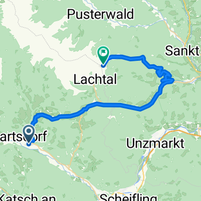 Lachtal 1
- Distance
- 30.4 km
- Ascent
- 1,477 m
- Descent
- 407 m
- Location
- Oberwölz Stadt, Styria, Austria
 Schönberg-Lachtal 178a, Oberwölz Stadt nach Hauptstraße (Oberzeiring) 24, Oberzeiring
- Distance
- 11 km
- Ascent
- 5 m
- Descent
- 390 m
- Location
- Oberwölz Stadt, Styria, Austria
 Oberwölz-Salchau-Schönberg-Scheifling-Frojach-Hinterburg
- Distance
- 46.4 km
- Ascent
- 1,541 m
- Descent
- 1,510 m
- Location
- Oberwölz Stadt, Styria, Austria
 Oberwölz - Preg
- Distance
- 68.5 km
- Ascent
- 752 m
- Descent
- 973 m
- Location
- Oberwölz Stadt, Styria, Austria
 Oberwölz - St.Lambrecht
- Distance
- 46.7 km
- Ascent
- 924 m
- Descent
- 798 m
- Location
- Oberwölz Stadt, Styria, Austria
Open it in the app