

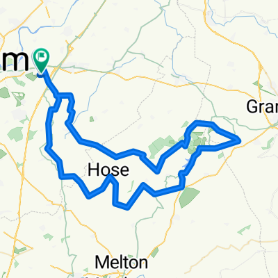
National Water Centre 70km
A cycling route starting in Radcliffe on Trent, England, United Kingdom.
Overview
About this route
round trip - start/end National Water Centre
- -:--
- Duration
- 69.3 km
- Distance
- 150 m
- Ascent
- 152 m
- Descent
- ---
- Avg. speed
- ---
- Max. altitude
Route quality
Waytypes & surfaces along the route
Waytypes
Road
56.1 km
(81 %)
Quiet road
11.8 km
(17 %)
Track
1.4 km
(2 %)
Surfaces
Paved
15.2 km
(22 %)
Unpaved
0.7 km
(1 %)
Asphalt
15.2 km
(22 %)
Unpaved (undefined)
0.7 km
(1 %)
Undefined
53.4 km
(77 %)
Continue with Bikemap
Use, edit, or download this cycling route
You would like to ride National Water Centre 70km or customize it for your own trip? Here is what you can do with this Bikemap route:
Free features
- Save this route as favorite or in collections
- Copy & plan your own version of this route
- Sync your route with Garmin or Wahoo
Premium features
Free trial for 3 days, or one-time payment. More about Bikemap Premium.
- Navigate this route on iOS & Android
- Export a GPX / KML file of this route
- Create your custom printout (try it for free)
- Download this route for offline navigation
Discover more Premium features.
Get Bikemap PremiumFrom our community
Other popular routes starting in Radcliffe on Trent
 ride from Gedling to Rushcliffe
- Distance
- 15.4 km
- Ascent
- 50 m
- Descent
- 46 m
- Location
- Radcliffe on Trent, England, United Kingdom
 Home, Lagoons, Stoke Lock, Gunthorpe
- Distance
- 23.1 km
- Ascent
- 13 m
- Descent
- 14 m
- Location
- Radcliffe on Trent, England, United Kingdom
 Belvoir Big One
- Distance
- 71.8 km
- Ascent
- 372 m
- Descent
- 374 m
- Location
- Radcliffe on Trent, England, United Kingdom
 ride through Gedling
- Distance
- 27.7 km
- Ascent
- 49 m
- Descent
- 47 m
- Location
- Radcliffe on Trent, England, United Kingdom
 Gunny
Gunny- Distance
- 15.3 km
- Ascent
- 0 m
- Descent
- 4 m
- Location
- Radcliffe on Trent, England, United Kingdom
 Saxondale and Nrth of A52
- Distance
- 39.1 km
- Ascent
- 97 m
- Descent
- 98 m
- Location
- Radcliffe on Trent, England, United Kingdom
 Both lakes, the racecourse and candle meadow
- Distance
- 4.6 km
- Ascent
- 69 m
- Descent
- 68 m
- Location
- Radcliffe on Trent, England, United Kingdom
 Crossland Meadows, both lakes and loop road
- Distance
- 6.5 km
- Ascent
- 24 m
- Descent
- 23 m
- Location
- Radcliffe on Trent, England, United Kingdom
Open it in the app