Vom Brigachtal über den Hochschwarzwald nach Rötenbach
A cycling route starting in Bad Dürrheim, Baden-Wurttemberg, Germany.
Overview
About this route
Brigachtal (Kirchdorf) - Fischerhof - Krumpenhof - Oberbränd - Rötenbach - Löffingen - Unadingen - Döggingen - Bräunlingen - Hüfingen - Allmendshofen - Donaueschingen - Brigachtal (Kirchdorf).
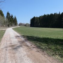
The route primarily runs on paths used for agricultural or forestry purposes; rarely is a road used!
- -:--
- Duration
- 80.9 km
- Distance
- 653 m
- Ascent
- 652 m
- Descent
- ---
- Avg. speed
- ---
- Max. altitude
Route quality
Waytypes & surfaces along the route
Waytypes
Track
55.8 km
(69 %)
Quiet road
15.4 km
(19 %)
Surfaces
Paved
34.8 km
(43 %)
Unpaved
38.8 km
(48 %)
Asphalt
22.6 km
(28 %)
Gravel
16.2 km
(20 %)
Continue with Bikemap
Use, edit, or download this cycling route
You would like to ride Vom Brigachtal über den Hochschwarzwald nach Rötenbach or customize it for your own trip? Here is what you can do with this Bikemap route:
Free features
- Save this route as favorite or in collections
- Copy & plan your own version of this route
- Split it into stages to create a multi-day tour
- Sync your route with Garmin or Wahoo
Premium features
Free trial for 3 days, or one-time payment. More about Bikemap Premium.
- Navigate this route on iOS & Android
- Export a GPX / KML file of this route
- Create your custom printout (try it for free)
- Download this route for offline navigation
Discover more Premium features.
Get Bikemap PremiumFrom our community
Other popular routes starting in Bad Dürrheim
Römerweg - Donaueschingen - Donauursprung 2- Distance
- 28.3 km
- Ascent
- 202 m
- Descent
- 201 m
- Location
- Bad Dürrheim, Baden-Wurttemberg, Germany
Bodensee 2020- Distance
- 69.5 km
- Ascent
- 324 m
- Descent
- 639 m
- Location
- Bad Dürrheim, Baden-Wurttemberg, Germany
Vom Brigachtal über den Hochschwarzwald nach Rötenbach- Distance
- 80.9 km
- Ascent
- 653 m
- Descent
- 652 m
- Location
- Bad Dürrheim, Baden-Wurttemberg, Germany
Dürrheim - Donau - Aasen - Dürrheim- Distance
- 25.3 km
- Ascent
- 49 m
- Descent
- 69 m
- Location
- Bad Dürrheim, Baden-Wurttemberg, Germany
EuroVelo6 - Part I: Donaueschingen - Wien- Distance
- 920.1 km
- Ascent
- 214 m
- Descent
- 712 m
- Location
- Bad Dürrheim, Baden-Wurttemberg, Germany
37_Schwenningen – Rottweil – Sulz- Distance
- 53.2 km
- Ascent
- 166 m
- Descent
- 449 m
- Location
- Bad Dürrheim, Baden-Wurttemberg, Germany
Heidenhofen Rundweg 01- Distance
- 16.5 km
- Ascent
- 202 m
- Descent
- 202 m
- Location
- Bad Dürrheim, Baden-Wurttemberg, Germany
Donauradweg- Distance
- 2,135.8 km
- Ascent
- 2,080 m
- Descent
- 2,744 m
- Location
- Bad Dürrheim, Baden-Wurttemberg, Germany
Open it in the app


