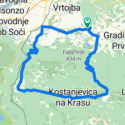
Kamnita - Stara železnica
A cycling route starting in Renče, Občina Renče-Vogrsko, Slovenia.
Overview
About this route
Od Svetega proti Temnici je del stare železniške proge zelo kamnit in precej težko vozen.
- -:--
- Duration
- 33.9 km
- Distance
- 643 m
- Ascent
- 643 m
- Descent
- ---
- Avg. speed
- ---
- Avg. speed
Route quality
Waytypes & surfaces along the route
Waytypes
Track
21.2 km
(63 %)
Quiet road
7.3 km
(21 %)
Surfaces
Paved
5.1 km
(15 %)
Unpaved
20.1 km
(59 %)
Gravel
7.3 km
(22 %)
Ground
6 km
(18 %)
Continue with Bikemap
Use, edit, or download this cycling route
You would like to ride Kamnita - Stara železnica or customize it for your own trip? Here is what you can do with this Bikemap route:
Free features
- Save this route as favorite or in collections
- Copy & plan your own version of this route
- Sync your route with Garmin or Wahoo
Premium features
Free trial for 3 days, or one-time payment. More about Bikemap Premium.
- Navigate this route on iOS & Android
- Export a GPX / KML file of this route
- Create your custom printout (try it for free)
- Download this route for offline navigation
Discover more Premium features.
Get Bikemap PremiumFrom our community
Other popular routes starting in Renče
- Brda 2 dan
- Distance
- 95 km
- Ascent
- 184 m
- Descent
- 181 m
- Location
- Renče, Občina Renče-Vogrsko, Slovenia
- Kamnita - Stara železnica
- Distance
- 33.9 km
- Ascent
- 643 m
- Descent
- 643 m
- Location
- Renče, Občina Renče-Vogrsko, Slovenia
- 2. Jesensko kolesarjenje po Krasu 13.10.2013
- Distance
- 45.9 km
- Ascent
- 471 m
- Descent
- 471 m
- Location
- Renče, Občina Renče-Vogrsko, Slovenia
- Brda 3 dan
- Distance
- 74.9 km
- Ascent
- 1,001 m
- Descent
- 929 m
- Location
- Renče, Občina Renče-Vogrsko, Slovenia
- Mtb tura Ita Kras
- Distance
- 45 km
- Ascent
- 579 m
- Descent
- 596 m
- Location
- Renče, Občina Renče-Vogrsko, Slovenia
- Bilje-Gorjansko-Nabrežina
- Distance
- 35.6 km
- Ascent
- 703 m
- Descent
- 709 m
- Location
- Renče, Občina Renče-Vogrsko, Slovenia
- Mtb tura Ita Kras
- Distance
- 44.8 km
- Ascent
- 559 m
- Descent
- 576 m
- Location
- Renče, Občina Renče-Vogrsko, Slovenia
- VD-AJ-COL-GODOVIČ-KALCE-VRHPOLJE-AJ-ŠEMPAS-BUKOVICA
- Distance
- 117.1 km
- Ascent
- 1,326 m
- Descent
- 1,326 m
- Location
- Renče, Občina Renče-Vogrsko, Slovenia
Open it in the app