

07/07/13 : St Jean sur Mayenne - Alençon
A cycling route starting in Saint-Jean-sur-Mayenne, Pays de la Loire Region, France.
Overview
About this route
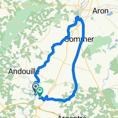
07/07/13 : St Jean sur Mayenne - Alençon
- -:--
- Duration
- 99.9 km
- Distance
- 498 m
- Ascent
- 407 m
- Descent
- ---
- Avg. speed
- ---
- Max. altitude

Route quality
Waytypes & surfaces along the route
Waytypes
Path
36.5 km
(37 %)
Quiet road
20 km
(20 %)
Surfaces
Paved
23.8 km
(24 %)
Unpaved
31.4 km
(31 %)
Gravel
31.4 km
(31 %)
Paved (undefined)
14.7 km
(15 %)
Continue with Bikemap
Use, edit, or download this cycling route
You would like to ride 07/07/13 : St Jean sur Mayenne - Alençon or customize it for your own trip? Here is what you can do with this Bikemap route:
Free features
- Save this route as favorite or in collections
- Copy & plan your own version of this route
- Split it into stages to create a multi-day tour
- Sync your route with Garmin or Wahoo
Premium features
Free trial for 3 days, or one-time payment. More about Bikemap Premium.
- Navigate this route on iOS & Android
- Export a GPX / KML file of this route
- Create your custom printout (try it for free)
- Download this route for offline navigation
Discover more Premium features.
Get Bikemap PremiumFrom our community
Other popular routes starting in Saint-Jean-sur-Mayenne
 De 4 Les Valinières, Saint-Jean-sur-Mayenne à 10–14 Place de la Payse, Lezay
- Distance
- 262.3 km
- Ascent
- 546 m
- Descent
- 472 m
- Location
- Saint-Jean-sur-Mayenne, Pays de la Loire Region, France
 De D131 à Bel air
- Distance
- 53.8 km
- Ascent
- 495 m
- Descent
- 452 m
- Location
- Saint-Jean-sur-Mayenne, Pays de la Loire Region, France
 Etape3 MSM: de St Germain à Soucé
- Distance
- 56.5 km
- Ascent
- 224 m
- Descent
- 185 m
- Location
- Saint-Jean-sur-Mayenne, Pays de la Loire Region, France
 Boucle voies vertes Laval-Mayenne
- Distance
- 53.7 km
- Ascent
- 292 m
- Descent
- 275 m
- Location
- Saint-Jean-sur-Mayenne, Pays de la Loire Region, France
 St Jean sur Mayenne - Alençon
- Distance
- 99.8 km
- Ascent
- 494 m
- Descent
- 403 m
- Location
- Saint-Jean-sur-Mayenne, Pays de la Loire Region, France
 hilly thing
- Distance
- 5 km
- Ascent
- 71 m
- Descent
- 65 m
- Location
- Saint-Jean-sur-Mayenne, Pays de la Loire Region, France
 De Rue de la Mairie à Bel air
- Distance
- 53.3 km
- Ascent
- 500 m
- Descent
- 446 m
- Location
- Saint-Jean-sur-Mayenne, Pays de la Loire Region, France
 Rue de Fouilloux to Les Hiaulmes
- Distance
- 5.1 km
- Ascent
- 88 m
- Descent
- 119 m
- Location
- Saint-Jean-sur-Mayenne, Pays de la Loire Region, France
Open it in the app