

Cross Country Route
A cycling route starting in Terrebonne, Oregon, United States.
Overview
About this route
Ron & Bobbi left Redmond, OR on Saturday, May 24 bicycing to Virginia.
- -:--
- Duration
- 4,851 km
- Distance
- 3,173 m
- Ascent
- 3,919 m
- Descent
- ---
- Avg. speed
- ---
- Max. altitude

Route highlights
Points of interest along the route
Point of interest after 97.9 km
End of Day 1 - 63 miles
Point of interest after 204.8 km
End of Day 2 - about 61 miles
Point of interest after 247.7 km
End of Day 3 - First Motel
Point of interest after 469.2 km
End of Day 4 - Motel in Ontario, rode 130 miles that day!
Point of interest after 660 km
Flat tire repair pit stop.
Point of interest after 689.3 km
End of Day 5 - Another 118 miles = TOTAL of 424 miles
Point of interest after 699.1 km
Night 5: May 28, 2014 - Redford Motel in Glenns Ferry, ID
Point of interest after 789.4 km
Day 6 - Jerome, ID
Point of interest after 951.5 km
Day 8 Pit Stop: Indian Hot Springs Resort & RV (about 50 miles on day 8)
Point of interest after 991.3 km
Day trip with Paul & Carol on Day 10
Point of interest after 995.8 km
Day 9 Pit Stop: Pocatello, ID Resting up at Motel 6 (About 27 mile ride today)
Point of interest after 1,092.3 km
Day 10 sleepover: Soda Springs About 660 miles
Point of interest after 1,137.5 km
Lunch at an abandoned RV park
Point of interest after 1,195.2 km
Day 12 endpoint - Cokeville, WY
Point of interest after 1,259.4 km
Port of Entry - End of Day 13
Point of interest after 1,401.2 km
Day 15 Pitstop - Rock Springs, WY
Point of interest after 1,533.6 km
Day 17 Pit Stop - Wamsutter, WY
Point of interest after 1,605.2 km
Day 18 - Rawlins, WY - Pitstop
Point of interest after 1,963.6 km
Lunch at the cemetery
Point of interest after 2,045.5 km
Day 23 Pitstop - Fort Morgan, CO
Point of interest after 2,131.6 km
Day 24 Pitstop - Yuma, CO
Point of interest after 2,214.7 km
Day 25 Pitstop - Camping somewhere between Wray and Burlington, CO amidst nearly 100 degree weather and cacti!
Point of interest after 2,254.2 km
Day 26 Pitstop - Burlington, CO
Point of interest after 2,361.1 km
Colorado/Kansas Border
Point of interest after 2,423.6 km
Day 28 Pitstop - Leoti, KS
Point of interest after 2,504.7 km
Day 29 Pitstop - Dighton, KS
Point of interest after 2,660.8 km
Day 30-32 Pitstop - Great Bend, KS
Point of interest after 3,203.6 km
Day 27 Pitstop - Sheridan Lake
Point of interest after 3,638.4 km
Day 33 Pitstop - McPherson, KS
Point of interest after 3,750.5 km
Day 34 Pitstop - El Dorado, KS
Point of interest after 3,853.8 km
Day 35 & 36 Pit Stop - Yates Center, KS
Point of interest after 3,951.5 km
Day 37 Pitstop - Fort Scott, KS
Point of interest after 4,528.9 km
Day 52 Pit Stop
Point of interest after 4,630.7 km
Day 53 Pitstop
Point of interest after 4,716.3 km
Day 54 Pitstop
Point of interest after 4,782.8 km
Day 55 Pitstop
Point of interest after 4,851 km
Days 56 & 57 Pitstop
Continue with Bikemap
Use, edit, or download this cycling route
You would like to ride Cross Country Route or customize it for your own trip? Here is what you can do with this Bikemap route:
Free features
- Save this route as favorite or in collections
- Copy & plan your own version of this route
- Split it into stages to create a multi-day tour
- Sync your route with Garmin or Wahoo
Premium features
Free trial for 3 days, or one-time payment. More about Bikemap Premium.
- Navigate this route on iOS & Android
- Export a GPX / KML file of this route
- Create your custom printout (try it for free)
- Download this route for offline navigation
Discover more Premium features.
Get Bikemap PremiumFrom our community
Other popular routes starting in Terrebonne
 Northeast 29th Street 4288, Redmond to Northeast 33rd Street 4750, Redmond
- Distance
- 18.6 km
- Ascent
- 145 m
- Descent
- 148 m
- Location
- Terrebonne, Oregon, United States
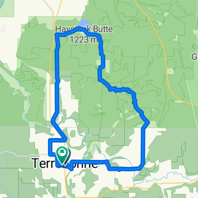 Terrebone, Haystack, Smith Rock
- Distance
- 53.8 km
- Ascent
- 748 m
- Descent
- 747 m
- Location
- Terrebonne, Oregon, United States
 r226 ROAM
- Distance
- 116.1 km
- Ascent
- 669 m
- Descent
- 965 m
- Location
- Terrebonne, Oregon, United States
 sisters2
- Distance
- 90.3 km
- Ascent
- 466 m
- Descent
- 221 m
- Location
- Terrebonne, Oregon, United States
 Terrebonne Cycling
- Distance
- 31.7 km
- Ascent
- 232 m
- Descent
- 231 m
- Location
- Terrebonne, Oregon, United States
 Relaxed route in Terrebonne
- Distance
- 4 km
- Ascent
- 108 m
- Descent
- 110 m
- Location
- Terrebonne, Oregon, United States
 Terrebonne Cycling
- Distance
- 21.7 km
- Ascent
- 164 m
- Descent
- 153 m
- Location
- Terrebonne, Oregon, United States
 7th Street pub to Smith Rock State Park
- Distance
- 18.8 km
- Ascent
- 114 m
- Descent
- 64 m
- Location
- Terrebonne, Oregon, United States
Open it in the app