Reinsfeld-Rösterkopf-Teufelskopf-Reinsfeld
A cycling route starting in Reinsfeld, Rhineland-Palatinate, Germany.
Overview
About this route
Alles dabei: Asphalt, Schotter und Single Trail
- -:--
- Duration
- 43.2 km
- Distance
- 546 m
- Ascent
- 547 m
- Descent
- ---
- Avg. speed
- ---
- Avg. speed
Route quality
Waytypes & surfaces along the route
Waytypes
Track
37.5 km
(87 %)
Path
1.9 km
(4 %)
Surfaces
Paved
13.5 km
(31 %)
Unpaved
28.9 km
(67 %)
Gravel
13.8 km
(32 %)
Unpaved (undefined)
9 km
(21 %)
Continue with Bikemap
Use, edit, or download this cycling route
You would like to ride Reinsfeld-Rösterkopf-Teufelskopf-Reinsfeld or customize it for your own trip? Here is what you can do with this Bikemap route:
Free features
- Save this route as favorite or in collections
- Copy & plan your own version of this route
- Sync your route with Garmin or Wahoo
Premium features
Free trial for 3 days, or one-time payment. More about Bikemap Premium.
- Navigate this route on iOS & Android
- Export a GPX / KML file of this route
- Create your custom printout (try it for free)
- Download this route for offline navigation
Discover more Premium features.
Get Bikemap PremiumFrom our community
Other popular routes starting in Reinsfeld
- Reinsfeld -Oberlimberg
- Distance
- 71.3 km
- Ascent
- 394 m
- Descent
- 534 m
- Location
- Reinsfeld, Rhineland-Palatinate, Germany
- Direkt von Kell am See nach Hasborn-Dautweiler
- Distance
- 27.3 km
- Ascent
- 572 m
- Descent
- 882 m
- Location
- Reinsfeld, Rhineland-Palatinate, Germany
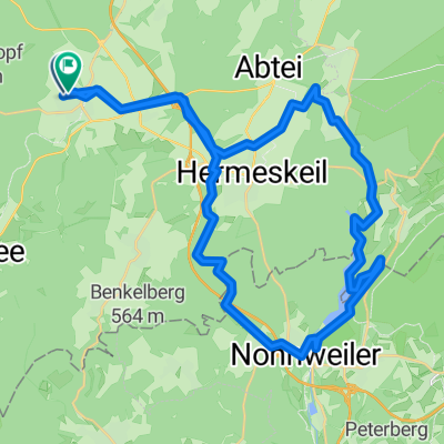
- 2014 Ruwer Hochwald Bahntrasse Reinsfeld-Hentern
- Distance
- 20.6 km
- Ascent
- 199 m
- Descent
- 366 m
- Location
- Reinsfeld, Rhineland-Palatinate, Germany
- Reinsfeld - Waldrach
- Distance
- 17.9 km
- Ascent
- 314 m
- Descent
- 653 m
- Location
- Reinsfeld, Rhineland-Palatinate, Germany
- Nonnweiler Stausee
- Distance
- 41 km
- Ascent
- 416 m
- Descent
- 424 m
- Location
- Reinsfeld, Rhineland-Palatinate, Germany
- Reinsfeld
- Distance
- 7.7 km
- Ascent
- 140 m
- Descent
- 140 m
- Location
- Reinsfeld, Rhineland-Palatinate, Germany
- Hochwald Radweg
- Distance
- 43.4 km
- Ascent
- 99 m
- Descent
- 461 m
- Location
- Reinsfeld, Rhineland-Palatinate, Germany
- Reinsfeld-Rösterkopf-Teufelskopf-Reinsfeld
- Distance
- 43.2 km
- Ascent
- 546 m
- Descent
- 547 m
- Location
- Reinsfeld, Rhineland-Palatinate, Germany
Open it in the app