

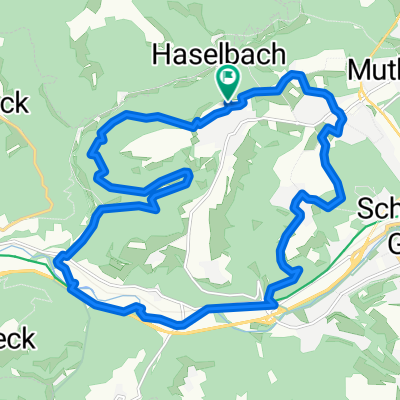
Mutlangen - Ebnisee
A cycling route starting in Mutlangen, Baden-Wurttemberg, Germany.
Overview
About this route
From Mutlangen, you descend through Großdeinbach into the Remstal valley. From there over Lorch - Weitmars, through the Walkersbach valley up to Haghof. After Welzheim, passing through Welheim towards Kaisersbach, to Ebnisee, to the Laufen mill, Welzheim, Breitenfürst, Pfahlbronn, Alfdorf, and finally back to Mutlangen.
- -:--
- Duration
- 60.4 km
- Distance
- 757 m
- Ascent
- 723 m
- Descent
- ---
- Avg. speed
- 569 m
- Max. altitude
Route quality
Waytypes & surfaces along the route
Waytypes
Road
18.7 km
(31 %)
Quiet road
12.1 km
(20 %)
Surfaces
Paved
46.5 km
(77 %)
Unpaved
1.8 km
(3 %)
Asphalt
42.9 km
(71 %)
Paved (undefined)
3.6 km
(6 %)
Continue with Bikemap
Use, edit, or download this cycling route
You would like to ride Mutlangen - Ebnisee or customize it for your own trip? Here is what you can do with this Bikemap route:
Free features
- Save this route as favorite or in collections
- Copy & plan your own version of this route
- Sync your route with Garmin or Wahoo
Premium features
Free trial for 3 days, or one-time payment. More about Bikemap Premium.
- Navigate this route on iOS & Android
- Export a GPX / KML file of this route
- Create your custom printout (try it for free)
- Download this route for offline navigation
Discover more Premium features.
Get Bikemap PremiumFrom our community
Other popular routes starting in Mutlangen
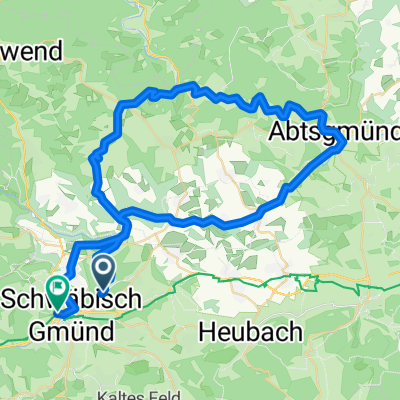
 Reichenbachsee
- Distance
- 28.4 km
- Ascent
- 249 m
- Descent
- 249 m
- Location
- Mutlangen, Baden-Wurttemberg, Germany
 Rehnenmühle
- Distance
- 17.1 km
- Ascent
- 173 m
- Descent
- 174 m
- Location
- Mutlangen, Baden-Wurttemberg, Germany
 Schwäbisch Gmünd - Lorch - Limes - Lindach - Schwäbisch Gmünd
- Distance
- 35.5 km
- Ascent
- 280 m
- Descent
- 263 m
- Location
- Mutlangen, Baden-Wurttemberg, Germany
 2009 01
- Distance
- 40.6 km
- Ascent
- 387 m
- Descent
- 484 m
- Location
- Mutlangen, Baden-Wurttemberg, Germany
 leital kochertal
- Distance
- 58.3 km
- Ascent
- 697 m
- Descent
- 638 m
- Location
- Mutlangen, Baden-Wurttemberg, Germany
 Spraitbach - Durlangen
- Distance
- 31.5 km
- Ascent
- 269 m
- Descent
- 270 m
- Location
- Mutlangen, Baden-Wurttemberg, Germany
 Mutlangen - Ebnisee
- Distance
- 60.4 km
- Ascent
- 757 m
- Descent
- 723 m
- Location
- Mutlangen, Baden-Wurttemberg, Germany
 Deinbach-Haselbach-Lorch-Gmünd-Wustenriet-Waldau-Deinbach
- Distance
- 19.7 km
- Ascent
- 319 m
- Descent
- 316 m
- Location
- Mutlangen, Baden-Wurttemberg, Germany
Open it in the app