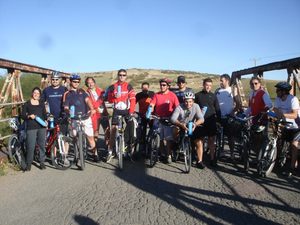
VUELTA DE CANESSA X GRUMBEIN
A cycling route starting in Bahía Blanca, Buenos Aires, Argentina.
Overview
About this route
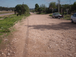
Start and Finish: Lainez Roundabout 3100-------------- take route 229, continue along the dirt road that starts behind the Grumbein silos,, follow the path, passing by Calderon and arriving at the intersection with old route 3, turn left and as soon as you cross the tracks, take the secondary road to the right,, after 5 km. we cross route 51, continue on the dirt road, we reach Corti station,, keep pedaling and we encounter Puente Canessa,,, climb the hill to return to the Carrindanga road,, to the bridge crossing the tracks, we go up it and follow the road until the intersection with the roundabout in the Patagonia neighborhood, we go down to the parallel to the road. (J. Newbery) dirt and we head to the curve with Indiada, from there we continue on dirt and reach the Orbe service station, starting point.. end of the route.
- -:--
- Duration
- 61.6 km
- Distance
- 144 m
- Ascent
- 135 m
- Descent
- ---
- Avg. speed
- ---
- Max. altitude
Route quality
Waytypes & surfaces along the route
Waytypes
Quiet road
41.9 km
(68 %)
Road
6.2 km
(10 %)
Surfaces
Paved
18.5 km
(30 %)
Unpaved
36.3 km
(59 %)
Unpaved (undefined)
30.8 km
(50 %)
Asphalt
16.6 km
(27 %)
Route highlights
Points of interest along the route

Point of interest after 35 km
PUENTE CANESSA

Point of interest after 58.1 km
CALLE INDIADA.. paralela a Av. Rosas
Continue with Bikemap
Use, edit, or download this cycling route
You would like to ride VUELTA DE CANESSA X GRUMBEIN or customize it for your own trip? Here is what you can do with this Bikemap route:
Free features
- Save this route as favorite or in collections
- Copy & plan your own version of this route
- Sync your route with Garmin or Wahoo
Premium features
Free trial for 3 days, or one-time payment. More about Bikemap Premium.
- Navigate this route on iOS & Android
- Export a GPX / KML file of this route
- Create your custom printout (try it for free)
- Download this route for offline navigation
Discover more Premium features.
Get Bikemap PremiumFrom our community
Other popular routes starting in Bahía Blanca
 Bahía - Pehuen-Co
- Distance
- 88.5 km
- Ascent
- 125 m
- Descent
- 142 m
- Location
- Bahía Blanca, Buenos Aires, Argentina
 Calderón - Corti - Canessa por tierra con señales
- Distance
- 79.6 km
- Ascent
- 145 m
- Descent
- 147 m
- Location
- Bahía Blanca, Buenos Aires, Argentina
 Bahía Blanca - Argerich
- Distance
- 39.6 km
- Ascent
- 38 m
- Descent
- 58 m
- Location
- Bahía Blanca, Buenos Aires, Argentina
 Ría por el salitral
- Distance
- 100.1 km
- Ascent
- 161 m
- Descent
- 166 m
- Location
- Bahía Blanca, Buenos Aires, Argentina
 Vuelta a la Vitícola
- Distance
- 80.3 km
- Ascent
- 175 m
- Descent
- 176 m
- Location
- Bahía Blanca, Buenos Aires, Argentina
 VUELTA DE CANESSA X GRUMBEIN
- Distance
- 61.6 km
- Ascent
- 144 m
- Descent
- 135 m
- Location
- Bahía Blanca, Buenos Aires, Argentina
 BAHIA BLANCA: ALTOS DEL ÑATO
- Distance
- 12.7 km
- Ascent
- 72 m
- Descent
- 72 m
- Location
- Bahía Blanca, Buenos Aires, Argentina
 Bahía blanca - pehuen co
- Distance
- 82.1 km
- Ascent
- 466 m
- Descent
- 481 m
- Location
- Bahía Blanca, Buenos Aires, Argentina
Open it in the app


