

Main-Radweg: Etappe 2: Kulmbach-Lichtenfels
A cycling route starting in Kulmbach, Bavaria, Germany.
Overview
About this route
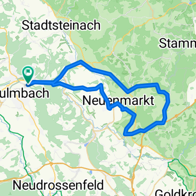
Die Etappe beginnt in Kulmbach, geht über Burgkunstadt und endet in Lichtenfels.
Nachdem man die „Bierstadt“ Kulmbach näher betrachtet hat, geht es weiter bis nach Burgkunstadt. Hier sind die schönen Fachwerkhäuser sowie der Jüdische Friedhof sehenswert. Die Strecke verläuft mit dem Rad meist eben weiter bis nach Lichtenfels. Die Korbmacherstadt mit seiner bezaubernden Innenstadt ist einen Besuch wert. - -:--
- Duration
- 36.7 km
- Distance
- 100 m
- Ascent
- 144 m
- Descent
- ---
- Avg. speed
- ---
- Avg. speed

Route quality
Waytypes & surfaces along the route
Waytypes
Quiet road
15.6 km
(43 %)
Track
7.3 km
(20 %)
Surfaces
Paved
32.1 km
(87 %)
Unpaved
1.6 km
(4 %)
Asphalt
30.5 km
(83 %)
Gravel
1.4 km
(4 %)
Continue with Bikemap
Use, edit, or download this cycling route
You would like to ride Main-Radweg: Etappe 2: Kulmbach-Lichtenfels or customize it for your own trip? Here is what you can do with this Bikemap route:
Free features
- Save this route as favorite or in collections
- Copy & plan your own version of this route
- Sync your route with Garmin or Wahoo
Premium features
Free trial for 3 days, or one-time payment. More about Bikemap Premium.
- Navigate this route on iOS & Android
- Export a GPX / KML file of this route
- Create your custom printout (try it for free)
- Download this route for offline navigation
Discover more Premium features.
Get Bikemap PremiumFrom our community
Other popular routes starting in Kulmbach
 Kulm Wirsb Himmelskron Neumarkt
- Distance
- 42.5 km
- Ascent
- 522 m
- Descent
- 522 m
- Location
- Kulmbach, Bavaria, Germany
 Kulmbach-Schneeberg und zurück
- Distance
- 83.2 km
- Ascent
- 1,074 m
- Descent
- 1,050 m
- Location
- Kulmbach, Bavaria, Germany
 Kulmbach - anspruchsvolle Runde
- Distance
- 92.3 km
- Ascent
- 1,110 m
- Descent
- 1,060 m
- Location
- Kulmbach, Bavaria, Germany
 Am Gründlein, Kulmbach nach Kettenbrückstraße, Bamberg
- Distance
- 89 km
- Ascent
- 791 m
- Descent
- 856 m
- Location
- Kulmbach, Bavaria, Germany
 Kulmbach-weisserMain-roterMain- weisserMain-Kulmbach
- Distance
- 49.6 km
- Ascent
- 400 m
- Descent
- 399 m
- Location
- Kulmbach, Bavaria, Germany
 Schorgasttal-Weißmaintal-Runde
- Distance
- 31.4 km
- Ascent
- 118 m
- Descent
- 116 m
- Location
- Kulmbach, Bavaria, Germany
 Kulmbach Wirsberg Hermes Kulmbach
- Distance
- 49.1 km
- Ascent
- 698 m
- Descent
- 695 m
- Location
- Kulmbach, Bavaria, Germany
 Rundweg Kulmbach - Wirsberg - Kulmbach
- Distance
- 31.3 km
- Ascent
- 130 m
- Descent
- 129 m
- Location
- Kulmbach, Bavaria, Germany
Open it in the app