
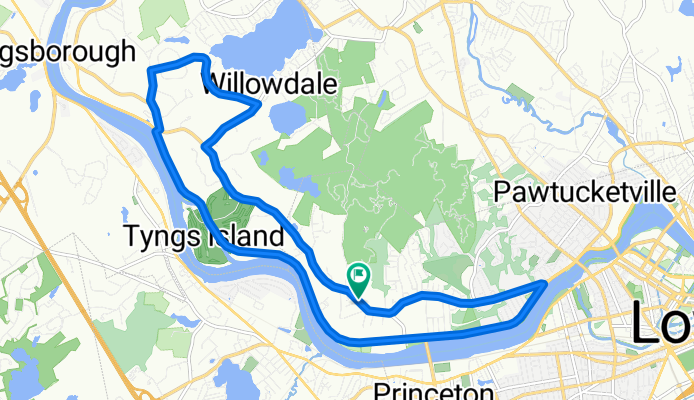
GLCF 3rd Annual Bike-A-Thon
A cycling route starting in Lowell, Massachusetts, United States of America.
Overview
About this route
The Greater Lowell community Foundation's River Ride is a great way to raise funds for a charity or nonprofit organization that matters to you! 100 percent of the money you or your team raise will go to your chosen nonprofit. Ride along the Merrimack River into Tyngsboro and through Lowell's Pawtucketville neighborhood with friends and colleagues.
- -:--
- Duration
- 17.2 km
- Distance
- 69 m
- Ascent
- 69 m
- Descent
- ---
- Avg. speed
- ---
- Max. altitude
Route quality
Waytypes & surfaces along the route
Waytypes
Busy road
12.1 km
(70 %)
Quiet road
3.6 km
(21 %)
Surfaces
Paved
6.5 km
(38 %)
Asphalt
6.5 km
(38 %)
Undefined
10.7 km
(62 %)
Continue with Bikemap
Use, edit, or download this cycling route
You would like to ride GLCF 3rd Annual Bike-A-Thon or customize it for your own trip? Here is what you can do with this Bikemap route:
Free features
- Save this route as favorite or in collections
- Copy & plan your own version of this route
- Sync your route with Garmin or Wahoo
Premium features
Free trial for 3 days, or one-time payment. More about Bikemap Premium.
- Navigate this route on iOS & Android
- Export a GPX / KML file of this route
- Create your custom printout (try it for free)
- Download this route for offline navigation
Discover more Premium features.
Get Bikemap PremiumFrom our community
Other popular routes starting in Lowell
 GLCF 3rd Annual Bike-A-Thon
- Distance
- 17.2 km
- Ascent
- 69 m
- Descent
- 69 m
- Location
- Lowell, Massachusetts, United States of America
 bike tour through Lowell
- Distance
- 10.9 km
- Ascent
- 56 m
- Descent
- 43 m
- Location
- Lowell, Massachusetts, United States of America
 Boxford Forest 45 - Boxford Forest 45
- Distance
- 72.8 km
- Ascent
- 629 m
- Descent
- 627 m
- Location
- Lowell, Massachusetts, United States of America
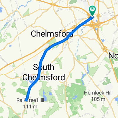 Bruce Freeman Rail Trail, Lowell to 980 Chelmsford St, Lowell
- Distance
- 19.3 km
- Ascent
- 87 m
- Descent
- 75 m
- Location
- Lowell, Massachusetts, United States of America
 Ups and Downs (CRW Long Ride)
- Distance
- 96.9 km
- Ascent
- 936 m
- Descent
- 945 m
- Location
- Lowell, Massachusetts, United States of America
 To Pollard
- Distance
- 16.3 km
- Ascent
- 90 m
- Descent
- 91 m
- Location
- Lowell, Massachusetts, United States of America
 favorite over river
- Distance
- 16.2 km
- Ascent
- 235 m
- Descent
- 219 m
- Location
- Lowell, Massachusetts, United States of America
 Bruce Freeman Rail Trail
- Distance
- 8 km
- Ascent
- 81 m
- Descent
- 86 m
- Location
- Lowell, Massachusetts, United States of America
Open it in the app