Trainingstour 1
- 43.2 km
- 143 m
- 143 m
- Erding, Bavaria, Germany
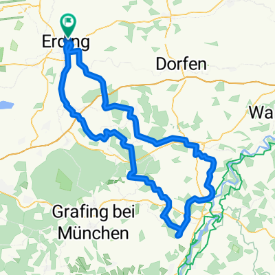
A cycling route starting in Erding, Bavaria, Germany.
Overview
Hilly loop to the east of Erding with some steep climbs. A total of around 1000 meters of elevation gain must be tackled. The route runs almost entirely on small side roads with little traffic. Nice beer garden to recharge and refill your energy reserves in Hohenpolding.
Route quality
Quiet road
52.1 km
(54 %)
Road
29 km
(30 %)
Paved
80.1 km
(83 %)
Unpaved
2.9 km
(3 %)
Asphalt
80.1 km
(83 %)
Gravel
2.9 km
(3 %)
Undefined
13.5 km
(14 %)
Continue with Bikemap
You would like to ride Hügelrunde im Erdinger Osten or customize it for your own trip? Here is what you can do with this Bikemap route:
Free trial for 3 days, or one-time payment. More about Bikemap Premium.
Discover more Premium features.
Get Bikemap PremiumFrom our community
Open it in the app