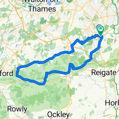
Newlands Corner - Boxhill - Banstead
- 60.9 km
- 489 m
- 489 m
- Banstead, England, United Kingdom
A cycling route starting in Banstead, England, United Kingdom.
Overview
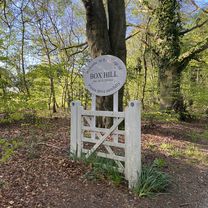
Starting in Banstead, over Epsom downs and Langley Vale. Over the M25 at Leatherhead, down Guidlford Rd. Up Newlands Corner, break at the visitor centre with some good views. A25 towards Dorking. Box Hill - zig zag lane. Back towards Banstead via Walton on the hill.
Route quality
Quiet road
11.6 km
(19 %)
Road
11 km
(18 %)
Paved
50 km
(82 %)
Unpaved
0.6 km
(1 %)
Asphalt
50 km
(82 %)
Ground
0.6 km
(1 %)
Undefined
10.4 km
(17 %)
Continue with Bikemap
You would like to ride Newlands Corner - Boxhill - Banstead or customize it for your own trip? Here is what you can do with this Bikemap route:
Free trial for 3 days, or one-time payment. More about Bikemap Premium.
Discover more Premium features.
Get Bikemap PremiumFrom our community
Open it in the app