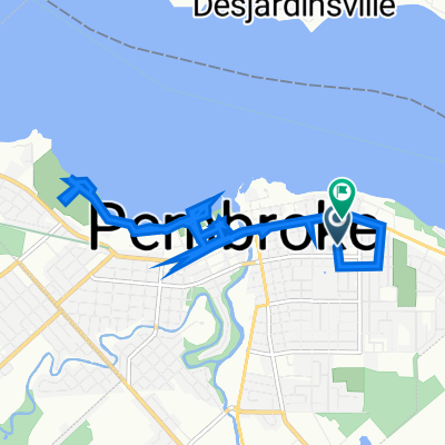
70 kmstafford 3rd line
A cycling route starting in Pembroke, Ontario, Canada.
Overview
About this route
Start at Whitewater service station.Â
- -:--
- Duration
- 69.7 km
- Distance
- 254 m
- Ascent
- 260 m
- Descent
- ---
- Avg. speed
- ---
- Avg. speed
Continue with Bikemap
Use, edit, or download this cycling route
You would like to ride 70 kmstafford 3rd line or customize it for your own trip? Here is what you can do with this Bikemap route:
Free features
- Save this route as favorite or in collections
- Copy & plan your own version of this route
- Sync your route with Garmin or Wahoo
Premium features
Free trial for 3 days, or one-time payment. More about Bikemap Premium.
- Navigate this route on iOS & Android
- Export a GPX / KML file of this route
- Create your custom printout (try it for free)
- Download this route for offline navigation
Discover more Premium features.
Get Bikemap PremiumFrom our community
Other popular routes starting in Pembroke
- 70 kmstafford 3rd line
- Distance
- 69.7 km
- Ascent
- 254 m
- Descent
- 260 m
- Location
- Pembroke, Ontario, Canada
- pembrooke, shawville
- Distance
- 79.6 km
- Ascent
- 447 m
- Descent
- 413 m
- Location
- Pembroke, Ontario, Canada
- Blistering ride
- Distance
- 6.3 km
- Ascent
- 0 m
- Descent
- 0 m
- Location
- Pembroke, Ontario, Canada
- Esther Street 480, Pembroke to Martin Street 493, Pembroke
- Distance
- 14.7 km
- Ascent
- 81 m
- Descent
- 58 m
- Location
- Pembroke, Ontario, Canada
- Bike route apr 24
- Distance
- 9.7 km
- Ascent
- 33 m
- Descent
- 32 m
- Location
- Pembroke, Ontario, Canada
- Pembroke Street West 961 to Martin Street 493A, Pembroke
- Distance
- 35.4 km
- Ascent
- 152 m
- Descent
- 105 m
- Location
- Pembroke, Ontario, Canada
- Algonquin Trail
- Distance
- 72.5 km
- Ascent
- 191 m
- Descent
- 214 m
- Location
- Pembroke, Ontario, Canada
- 66 k route
- Distance
- 65.4 km
- Ascent
- 212 m
- Descent
- 212 m
- Location
- Pembroke, Ontario, Canada
Open it in the app