

Essen (City) - Ruhrtalradweg - Do-Oespel
A cycling route starting in Essen, North Rhine-Westphalia, Germany.
Overview
About this route
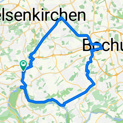
This tour goes from the city of Essen out to the Ruhr. Along the Ruhr Valley Cycling Path to the Kemnader Reservoir. Through Bo-Langendreer, we then head to Do-Oespel.
- -:--
- Duration
- 47.4 km
- Distance
- 336 m
- Ascent
- 308 m
- Descent
- ---
- Avg. speed
- 119 m
- Max. altitude
Route quality
Waytypes & surfaces along the route
Waytypes
Path
19.4 km
(41 %)
Quiet road
12.8 km
(27 %)
Surfaces
Paved
45.5 km
(96 %)
Unpaved
0.5 km
(1 %)
Asphalt
44.1 km
(93 %)
Concrete
1.4 km
(3 %)
Continue with Bikemap
Use, edit, or download this cycling route
You would like to ride Essen (City) - Ruhrtalradweg - Do-Oespel or customize it for your own trip? Here is what you can do with this Bikemap route:
Free features
- Save this route as favorite or in collections
- Copy & plan your own version of this route
- Sync your route with Garmin or Wahoo
Premium features
Free trial for 3 days, or one-time payment. More about Bikemap Premium.
- Navigate this route on iOS & Android
- Export a GPX / KML file of this route
- Create your custom printout (try it for free)
- Download this route for offline navigation
Discover more Premium features.
Get Bikemap PremiumFrom our community
Other popular routes starting in Essen
 Bahntrassentour Essen
- Distance
- 40.7 km
- Ascent
- 186 m
- Descent
- 186 m
- Location
- Essen, North Rhine-Westphalia, Germany
 Kray Bo-Jahrhunderthalle Ruhr Rundkurs
- Distance
- 33.8 km
- Ascent
- 154 m
- Descent
- 151 m
- Location
- Essen, North Rhine-Westphalia, Germany
 neues Rad
- Distance
- 56.8 km
- Ascent
- 195 m
- Descent
- 194 m
- Location
- Essen, North Rhine-Westphalia, Germany
 Essen Rundfahrt
- Distance
- 29.9 km
- Ascent
- 195 m
- Descent
- 194 m
- Location
- Essen, North Rhine-Westphalia, Germany
 Bahntrassenradeln
- Distance
- 51.8 km
- Ascent
- 168 m
- Descent
- 168 m
- Location
- Essen, North Rhine-Westphalia, Germany
 testlauf
- Distance
- 5.4 km
- Ascent
- 26 m
- Descent
- 29 m
- Location
- Essen, North Rhine-Westphalia, Germany
 Meine Neue Hausrunde
- Distance
- 47.1 km
- Ascent
- 485 m
- Descent
- 501 m
- Location
- Essen, North Rhine-Westphalia, Germany
 Um den See
- Distance
- 20.3 km
- Ascent
- 184 m
- Descent
- 187 m
- Location
- Essen, North Rhine-Westphalia, Germany
Open it in the app