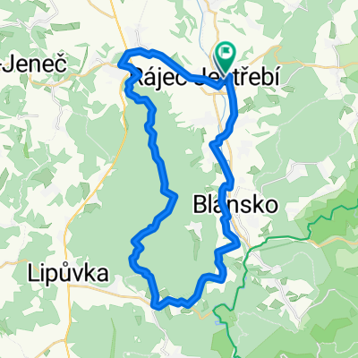
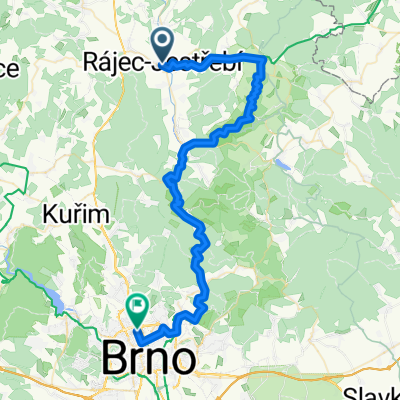
JeskynÄ› Mor. Kr.
A cycling route starting in Rájec-JestĹ™ebĂ, South Moravian, Czechia.
Overview
About this route
Vlakem do Rájec- JestĹ™ebĂ a od tam do Sloupu, pak pĹ™es nádhernĂ˝ ĂşdolĂ Ĺ™eky Punkvy, Rudice a KĹ™tiny do Adamova (eventuálnĂ ukonÄŤenĂ cesty a vlakem zpÄ›t do Brna) nebo pokraÄŤovánĂ na kole podĂ©l Svitavi do BĂlovic nebo aĹľ do Brna
- -:--
- Duration
- 54.1 km
- Distance
- 479 m
- Ascent
- 538 m
- Descent
- ---
- Avg. speed
- ---
- Avg. speed
Route quality
Waytypes & surfaces along the route
Waytypes
Busy road
23.5 km
(44 %)
Road
19.2 km
(35 %)
Surfaces
Paved
46.8 km
(87 %)
Unpaved
0.2 km
(<1 %)
Asphalt
46.4 km
(86 %)
Paving stones
0.4 km
(<1 %)
Route highlights
Points of interest along the route
Point of interest after 19.8 km
RĹŻznĂ© jeskynÄ›, propast Macocha a hlavnÄ› krásnĂ© ĂşdolĂ, kde se jede pořád s kopce ;-)
Point of interest after 30 km
RudickĂ© propadánĂ
Point of interest after 35.2 km
PoutnĂ kostel
Point of interest after 36.5 km
Propadánà křtinského potoka a dalšà jeskyně
Point of interest after 40.3 km
Dalšà jeskyně
Continue with Bikemap
Use, edit, or download this cycling route
You would like to ride JeskynÄ› Mor. Kr. or customize it for your own trip? Here is what you can do with this Bikemap route:
Free features
- Save this route as favorite or in collections
- Copy & plan your own version of this route
- Sync your route with Garmin or Wahoo
Premium features
Free trial for 3 days, or one-time payment. More about Bikemap Premium.
- Navigate this route on iOS & Android
- Export a GPX / KML file of this route
- Create your custom printout (try it for free)
- Download this route for offline navigation
Discover more Premium features.
Get Bikemap PremiumFrom our community
Other popular routes starting in Rájec-JestĹ™ebĂ
- okruh blansko JV
- Distance
- 41.9 km
- Ascent
- 893 m
- Descent
- 861 m
- Location
- Rájec-JestĹ™ebĂ, South Moravian, Czechia
- MoravskĂ˝ kras_3
- Distance
- 14.1 km
- Ascent
- 219 m
- Descent
- 221 m
- Location
- Rájec-JestĹ™ebĂ, South Moravian, Czechia
- Boby_cas
- Distance
- 5.5 km
- Ascent
- 337 m
- Descent
- 0 m
- Location
- Rájec-JestĹ™ebĂ, South Moravian, Czechia
- Rájec-JestĹ™ebĂ_Bystrc
- Distance
- 45.3 km
- Ascent
- 508 m
- Descent
- 484 m
- Location
- Rájec-JestĹ™ebĂ, South Moravian, Czechia
- Blanenská, Rájec-JestĹ™ebĂ do Blanenská, Rájec-JestĹ™ebĂ
- Distance
- 71.4 km
- Ascent
- 1,334 m
- Descent
- 1,335 m
- Location
- Rájec-JestĹ™ebĂ, South Moravian, Czechia
- MoravskĂ˝ kras_4
- Distance
- 7.1 km
- Ascent
- 117 m
- Descent
- 116 m
- Location
- Rájec-JestĹ™ebĂ, South Moravian, Czechia
- JeskynÄ› Mor. Kr.
- Distance
- 54.1 km
- Ascent
- 479 m
- Descent
- 538 m
- Location
- Rájec-JestĹ™ebĂ, South Moravian, Czechia
- Rájec-Jestřebà - Sloup 🚴 - Macocha - Blansko - Adamov - Brno
- Distance
- 52.8 km
- Ascent
- 410 m
- Descent
- 489 m
- Location
- Rájec-JestĹ™ebĂ, South Moravian, Czechia
Open it in the app