

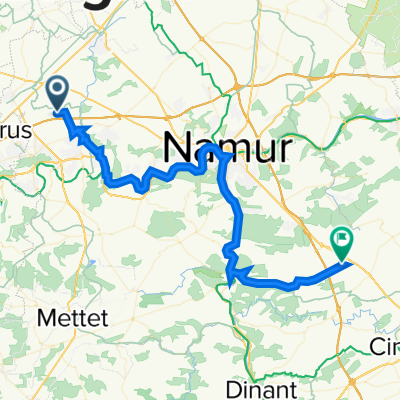
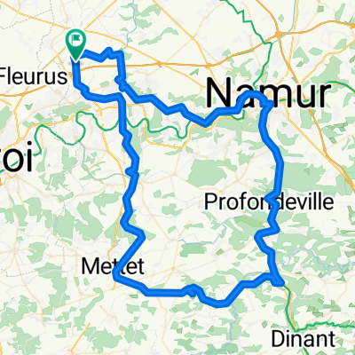
Long training run - about length of étape route
A cycling route starting in Sombreffe, Wallonia, Belgium.
Overview
About this route
Long training route to circle to the south of Charleroi from Uccle and back - about the same length as the étape du tour 2014 route.
I have found it hard to locate a rut swinging south of Charleroi - I think I'vedone it here - but to plot it otI started from the place where I'd deviate from my norml route rather than here I start - which is in Uccle in Brusses...so the profile is odd a I plan the route t finish "hilly" so as to "empty te tank"....- -:--
- Duration
- 148 km
- Distance
- 614 m
- Ascent
- 617 m
- Descent
- ---
- Avg. speed
- ---
- Max. altitude

Route quality
Waytypes & surfaces along the route
Waytypes
Busy road
78.3 km
(53 %)
Quiet road
28.2 km
(19 %)
Surfaces
Paved
75.3 km
(51 %)
Unpaved
0.2 km
(<1 %)
Asphalt
71.9 km
(49 %)
Paving stones
2.5 km
(2 %)
Continue with Bikemap
Use, edit, or download this cycling route
You would like to ride Long training run - about length of étape route or customize it for your own trip? Here is what you can do with this Bikemap route:
Free features
- Save this route as favorite or in collections
- Copy & plan your own version of this route
- Split it into stages to create a multi-day tour
- Sync your route with Garmin or Wahoo
Premium features
Free trial for 3 days, or one-time payment. More about Bikemap Premium.
- Navigate this route on iOS & Android
- Export a GPX / KML file of this route
- Create your custom printout (try it for free)
- Download this route for offline navigation
Discover more Premium features.
Get Bikemap PremiumFrom our community
Other popular routes starting in Sombreffe
 Promenade autour du Gembloux
- Distance
- 47.5 km
- Ascent
- 373 m
- Descent
- 372 m
- Location
- Sombreffe, Wallonia, Belgium
 77 kil from Sombreffe
- Distance
- 77.3 km
- Ascent
- 383 m
- Descent
- 383 m
- Location
- Sombreffe, Wallonia, Belgium
 1-Balâtre - Assesse
- Distance
- 54.4 km
- Ascent
- 633 m
- Descent
- 521 m
- Location
- Sombreffe, Wallonia, Belgium
 Tongrinne -> Onhaye
- Distance
- 44.4 km
- Ascent
- 423 m
- Descent
- 379 m
- Location
- Sombreffe, Wallonia, Belgium
 1 Balatre - Le roeulx
- Distance
- 53.7 km
- Ascent
- 217 m
- Descent
- 227 m
- Location
- Sombreffe, Wallonia, Belgium
 Petit décrassage hivernal
- Distance
- 28 km
- Ascent
- 194 m
- Descent
- 192 m
- Location
- Sombreffe, Wallonia, Belgium
 Relais de Charlinette-Relais de Charlinette
- Distance
- 99.6 km
- Ascent
- 530 m
- Descent
- 532 m
- Location
- Sombreffe, Wallonia, Belgium
 Long training run - about length of étape route
- Distance
- 148 km
- Ascent
- 614 m
- Descent
- 617 m
- Location
- Sombreffe, Wallonia, Belgium
Open it in the app