Am Stausee 10, Friesoythe do Breslauer Straße 5, Garrel
- 36.4 km
- 7 m
- 27 m
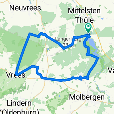
- Garrel, Lower Saxony, Germany
A cycling route starting in Garrel, Lower Saxony, Germany.
Overview
Bike course of the Thülsfelder Reservoir triathlon
created this 11 years ago
Route quality
Quiet road
9.2 km
(46 %)
Cycleway
4.2 km
(21 %)
Paved
13.2 km
(66 %)
Asphalt
13.2 km
(66 %)
Undefined
6.8 km
(34 %)
Continue with Bikemap
You would like to ride Triathlon Thülsfelder Talsperre Radstrecke 2014 or customize it for your own trip? Here is what you can do with this Bikemap route:
Free trial for 3 days, or one-time payment. More about Bikemap Premium.
Discover more Premium features.
Get Bikemap PremiumFrom our community
Open it in the app