VPMP_25
A cycling route starting in Líbeznice, Central Bohemia, Czechia.
Overview
About this route
Upravená trasa 25. vejšlapu povodím Mratínského potoka
- -:--
- Duration
- 64 km
- Distance
- 103 m
- Ascent
- 103 m
- Descent
- ---
- Avg. speed
- ---
- Avg. speed
Continue with Bikemap
Use, edit, or download this cycling route
You would like to ride VPMP_25 or customize it for your own trip? Here is what you can do with this Bikemap route:
Free features
- Save this route as favorite or in collections
- Copy & plan your own version of this route
- Sync your route with Garmin or Wahoo
Premium features
Free trial for 3 days, or one-time payment. More about Bikemap Premium.
- Navigate this route on iOS & Android
- Export a GPX / KML file of this route
- Create your custom printout (try it for free)
- Download this route for offline navigation
Discover more Premium features.
Get Bikemap PremiumFrom our community
Other popular routes starting in Líbeznice
- VPMP_20
- Distance
- 46.2 km
- Ascent
- 235 m
- Descent
- 235 m
- Location
- Líbeznice, Central Bohemia, Czechia
- VPMP_21
- Distance
- 59.5 km
- Ascent
- 109 m
- Descent
- 107 m
- Location
- Líbeznice, Central Bohemia, Czechia
- Jarní časovka jednotlivců - Bášť
- Distance
- 6.6 km
- Ascent
- 40 m
- Descent
- 40 m
- Location
- Líbeznice, Central Bohemia, Czechia
- Koko 2
- Distance
- 141.6 km
- Ascent
- 738 m
- Descent
- 737 m
- Location
- Líbeznice, Central Bohemia, Czechia
- lehká trasa pro zimní najíždění km
- Distance
- 50 km
- Ascent
- 153 m
- Descent
- 164 m
- Location
- Líbeznice, Central Bohemia, Czechia
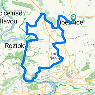
- Spící panna - časovka družstev
- Distance
- 33.5 km
- Ascent
- 151 m
- Descent
- 150 m
- Location
- Líbeznice, Central Bohemia, Czechia
- VPMP_22
- Distance
- 43.7 km
- Ascent
- 346 m
- Descent
- 346 m
- Location
- Líbeznice, Central Bohemia, Czechia
- VPMP_25
- Distance
- 64 km
- Ascent
- 103 m
- Descent
- 103 m
- Location
- Líbeznice, Central Bohemia, Czechia
Open it in the app