

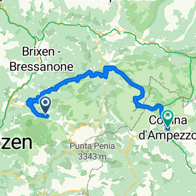
St. Ulrich - Saltria - Pufls - St. Ulrich
A cycling route starting in Urtijëi, Trentino-Alto Adige, Italy.
Overview
About this route
- -:--
- Duration
- 20.6 km
- Distance
- 901 m
- Ascent
- 904 m
- Descent
- ---
- Avg. speed
- 1,884 m
- Avg. speed

Route quality
Waytypes & surfaces along the route
Waytypes
Quiet road
12.5 km
(61 %)
Road
2.6 km
(12 %)
Surfaces
Paved
10.9 km
(53 %)
Unpaved
3 km
(15 %)
Asphalt
10.9 km
(53 %)
Loose gravel
2 km
(10 %)
Continue with Bikemap
Use, edit, or download this cycling route
You would like to ride St. Ulrich - Saltria - Pufls - St. Ulrich or customize it for your own trip? Here is what you can do with this Bikemap route:
Free features
- Save this route as favorite or in collections
- Copy & plan your own version of this route
- Sync your route with Garmin or Wahoo
Premium features
Free trial for 3 days, or one-time payment. More about Bikemap Premium.
- Navigate this route on iOS & Android
- Export a GPX / KML file of this route
- Create your custom printout (try it for free)
- Download this route for offline navigation
Discover more Premium features.
Get Bikemap PremiumFrom our community
Other popular routes starting in Urtijëi
 seiser alm - st. ulrich
- Distance
- 24.3 km
- Ascent
- 383 m
- Descent
- 1,161 m
- Location
- Urtijëi, Trentino-Alto Adige, Italy
 Sull'Alpe di Siusi tra malghe, masi e alpeggi
- Distance
- 25.5 km
- Ascent
- 632 m
- Descent
- 629 m
- Location
- Urtijëi, Trentino-Alto Adige, Italy
 Ortisei-Castelrotto, linksom
- Distance
- 38.7 km
- Ascent
- 1,123 m
- Descent
- 1,120 m
- Location
- Urtijëi, Trentino-Alto Adige, Italy
 AanloopErbe
- Distance
- 21.2 km
- Ascent
- 63 m
- Descent
- 828 m
- Location
- Urtijëi, Trentino-Alto Adige, Italy
 Raschötz val d anna
- Distance
- 17.5 km
- Ascent
- 1,025 m
- Descent
- 954 m
- Location
- Urtijëi, Trentino-Alto Adige, Italy
 Plattkofelrunde ohne
- Distance
- 22.9 km
- Ascent
- 893 m
- Descent
- 893 m
- Location
- Urtijëi, Trentino-Alto Adige, Italy
 St. Ulrich - Saltria - Pufls - St. Ulrich
- Distance
- 20.6 km
- Ascent
- 901 m
- Descent
- 904 m
- Location
- Urtijëi, Trentino-Alto Adige, Italy
 Streda Sneton, Ortisei to Via Guglielmo Marconi, Cortina d'Ampezzo
- Distance
- 102.7 km
- Ascent
- 5,133 m
- Descent
- 5,144 m
- Location
- Urtijëi, Trentino-Alto Adige, Italy
Open it in the app