

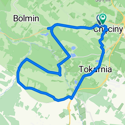
Tokarnia - Mosty - Choiny - Brzegi - Tokarnia
A cycling route starting in Chęciny, Świętokrzyskie Voivodship, Poland.
Overview
About this route
The loop around Tokarnia (Black and White Nida) - easy
- -:--
- Duration
- 21.6 km
- Distance
- 120 m
- Ascent
- 120 m
- Descent
- ---
- Avg. speed
- ---
- Max. altitude

Continue with Bikemap
Use, edit, or download this cycling route
You would like to ride Tokarnia - Mosty - Choiny - Brzegi - Tokarnia or customize it for your own trip? Here is what you can do with this Bikemap route:
Free features
- Save this route as favorite or in collections
- Copy & plan your own version of this route
- Sync your route with Garmin or Wahoo
Premium features
Free trial for 3 days, or one-time payment. More about Bikemap Premium.
- Navigate this route on iOS & Android
- Export a GPX / KML file of this route
- Create your custom printout (try it for free)
- Download this route for offline navigation
Discover more Premium features.
Get Bikemap PremiumFrom our community
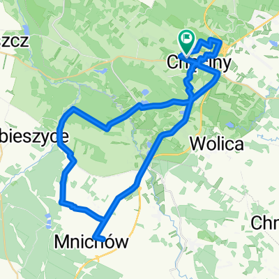
Other popular routes starting in Chęciny
 Góry Świętokrzyskie
- Distance
- 120.1 km
- Ascent
- 455 m
- Descent
- 474 m
- Location
- Chęciny, Świętokrzyskie Voivodship, Poland
 Spacerowa, Chęciny do Spacerowa, Chęciny
- Distance
- 33.8 km
- Ascent
- 368 m
- Descent
- 369 m
- Location
- Chęciny, Świętokrzyskie Voivodship, Poland
 Kieleckie 2
- Distance
- 59.4 km
- Ascent
- 762 m
- Descent
- 763 m
- Location
- Chęciny, Świętokrzyskie Voivodship, Poland
 Tokarnia - Mosty - Choiny - Brzegi - Tokarnia
- Distance
- 21.6 km
- Ascent
- 120 m
- Descent
- 120 m
- Location
- Chęciny, Świętokrzyskie Voivodship, Poland
 Tokarnia 303, Chęciny to Czarniecka Góra 64, Staporków
- Distance
- 175.9 km
- Ascent
- 755 m
- Descent
- 714 m
- Location
- Chęciny, Świętokrzyskie Voivodship, Poland
 Góry Świętokrzyskie dzień 2
- Distance
- 127.3 km
- Ascent
- 373 m
- Descent
- 440 m
- Location
- Chęciny, Świętokrzyskie Voivodship, Poland
 Spacerowa, Chęciny do Spacerowa, Chęciny
- Distance
- 46.5 km
- Ascent
- 494 m
- Descent
- 489 m
- Location
- Chęciny, Świętokrzyskie Voivodship, Poland
 Propozycja trasy 1
- Distance
- 63 km
- Ascent
- 371 m
- Descent
- 369 m
- Location
- Chęciny, Świętokrzyskie Voivodship, Poland
Open it in the app