- 43.9 km
- 1,504 m
- 1,485 m
- Sëlva, Trentino-Alto Adige, Italy
Sellaronda
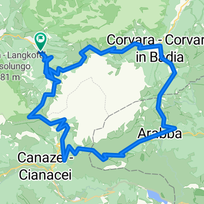
A cycling route starting in Sëlva, Trentino-Alto Adige, Italy.
Overview
About this route
Arrival Brenner Autobahn A22, coming from the north via Innsbruck-Brenner, from the south via Verona-Bolzano. The most convenient exit is called Klausen/Val Gardena. From there, on the well-signposted high road, you reach St. Ulrich after about 20 minutes and a few kilometers further on St. Christina and Wolkenstein.
Starting point About 500m after the beginning of the village of Wolkenstein on the left side is the Tourist Association. Parking: At the beginning of the Wolkenstein town centre, before Nives Square, turn left and then immediately left into the Nives parking garage. The tour starts at the Wolkenstein Tourist Association.
- -:--
- Duration
- 54.8 km
- Distance
- 3,322 m
- Ascent
- 3,322 m
- Descent
- ---
- Avg. speed
- ---
- Max. altitude
created this 11 years ago
Continue with Bikemap
Use, edit, or download this cycling route
You would like to ride Sellaronda or customize it for your own trip? Here is what you can do with this Bikemap route:
Free features
- Save this route as favorite or in collections
- Copy & plan your own version of this route
- Sync your route with Garmin or Wahoo
Premium features
Free trial for 3 days, or one-time payment. More about Bikemap Premium.
- Navigate this route on iOS & Android
- Export a GPX / KML file of this route
- Create your custom printout (try it for free)
- Download this route for offline navigation
Discover more Premium features.
Get Bikemap PremiumFrom our community
Other popular routes starting in Sëlva
- Wolkenstein Seiseralm Wolkenstein 2023
- Sella Mounainbike Runde
- 59.2 km
- 2,746 m
- 2,732 m
- Sëlva, Trentino-Alto Adige, Italy
- Sellaronda (asfalto)
- 61.7 km
- 1,935 m
- 1,934 m
- Sëlva, Trentino-Alto Adige, Italy
- DO_5_Passo Gardena_BOLZANO
- 68.5 km
- 31 m
- 1,877 m
- Sëlva, Trentino-Alto Adige, Italy
- Sellaronda
- 54.8 km
- 3,322 m
- 3,322 m
- Sëlva, Trentino-Alto Adige, Italy
- Sellaronda Hero 2010 (50km)
- 49.6 km
- 2,167 m
- 2,184 m
- Sëlva, Trentino-Alto Adige, Italy
- SRBD - Selva Val Gardena
- 60.8 km
- 2,308 m
- 2,308 m
- Sëlva, Trentino-Alto Adige, Italy
- Rennradtour 016 SELLARONDA
- 59.9 km
- 1,960 m
- 1,960 m
- Sëlva, Trentino-Alto Adige, Italy
Open it in the app


