St Margaret's Loop (To Dunfermline)
A cycling route starting in North Queensferry, Scotland, United Kingdom.
Overview
About this route
St Margaret’s Loop (North Queensferry to Dunfermline and back)
Brief Description. This is a varied and attractive cross-country route which takes you to Dunfermline and the burial place of St Margaret (Queen Margaret) of Scotland and other Scottish kings. You can either cycle back (mainly downhill) along the busy bus route, or take the bus back to your start point.
Part of the Way of St Andrews
http://www.thewayofstandrews.com/
Detailed Route (We strongly recommend that you print out the instructions below and map of this route. Also we recommend, for more information about the area, an Ordnance Survey map. These are available in most tourist and information shops.)
Forth Road Bridge to Rosyth Castle (3 km).
On arrival at the north end of Forth Road Bridge take the steps down beside the motorway on to the road below (B981) and set off west under the motorway along the footpath. Great views of the three bridges. After 200m you will pass the Hilton Hotel on the right. Continue along this road, with a broad walkway, under the new bridge, the Queensferry Crossing, then another 400m to crossroads. Turn left signposted to Rosyth 1 mile and Bike Route 76.
(OR , on arrival at Park and Ride Inverkeithing beside motorway.
Follow signs west to Rosyth under motorway and along the A895 and past the white pillars of the entrance to Castlandhill Houses to crossroads , then continue as below)
St Margaret’s Loop is also easily accessed from North Queensferry Railway Station.
Proceed along the footpath beside this busy road, after 200 m you will see two white pillars on the right, the entrance to Castlelandhill House, keep going straight along this road for 300 m to a small roundabout. Follow the sign to Rosyth Euro Park. On your right you will see a series of concrete pillars, the forbidding remains of storage facilities, dating from the Second World War. Ahead and on the left you will see the red stone roofless ruin of Rosyth Castle. After 1 km and bout 100 m short of the castle you will see a signpost marked Bike route 76 with another sign, the yellow arrow of Fife Coastal Path, pointing right. This is the route to follow, but you may want to continue along the road for another 100 m, cross over the disused railway line and have a look at Rosyth Castle.
Rosyth Castle to Douglasbank Cemetery (3 km)
Follow the Fife Coastal Path up along a woodland path past an old dovecot with information board for about 600m until you reach the main road. Continue left along the footpath beside this main road for 200 m to a roundabout dominated by a ship-shaped building with a steel roof. Take the second turning onto Hilton road and past buildings labelled Hilton Court for 300m until you reach post office/shop on left. Opposite take the road (signposted Fife Coastal Path) marked Wilson Way along footpath beside road for 300 m then follow sign through gate. (marked Fife Coastal Path.). After 300 yards you will see a low pagoda- like building belonging to the Ministry of Defence and then you will arrive at another signpost marked Public Footpath and Fife Coastal Path where it takes a sharp left for 200 m, then a sharp right up a small hill. At the top of this hill you will suddenly get a view of the spires of Dunfermline. This path continues for another 200m until it joins a busy road (A985). Turn left along the footpath and proceed along for 1000 m until you arrive at large yellow house on the left. There take turning to the right to Pattiesmuir and Douglasbank Cemetery.
Douglasbank Cemetery to Dunfermline (5 km)
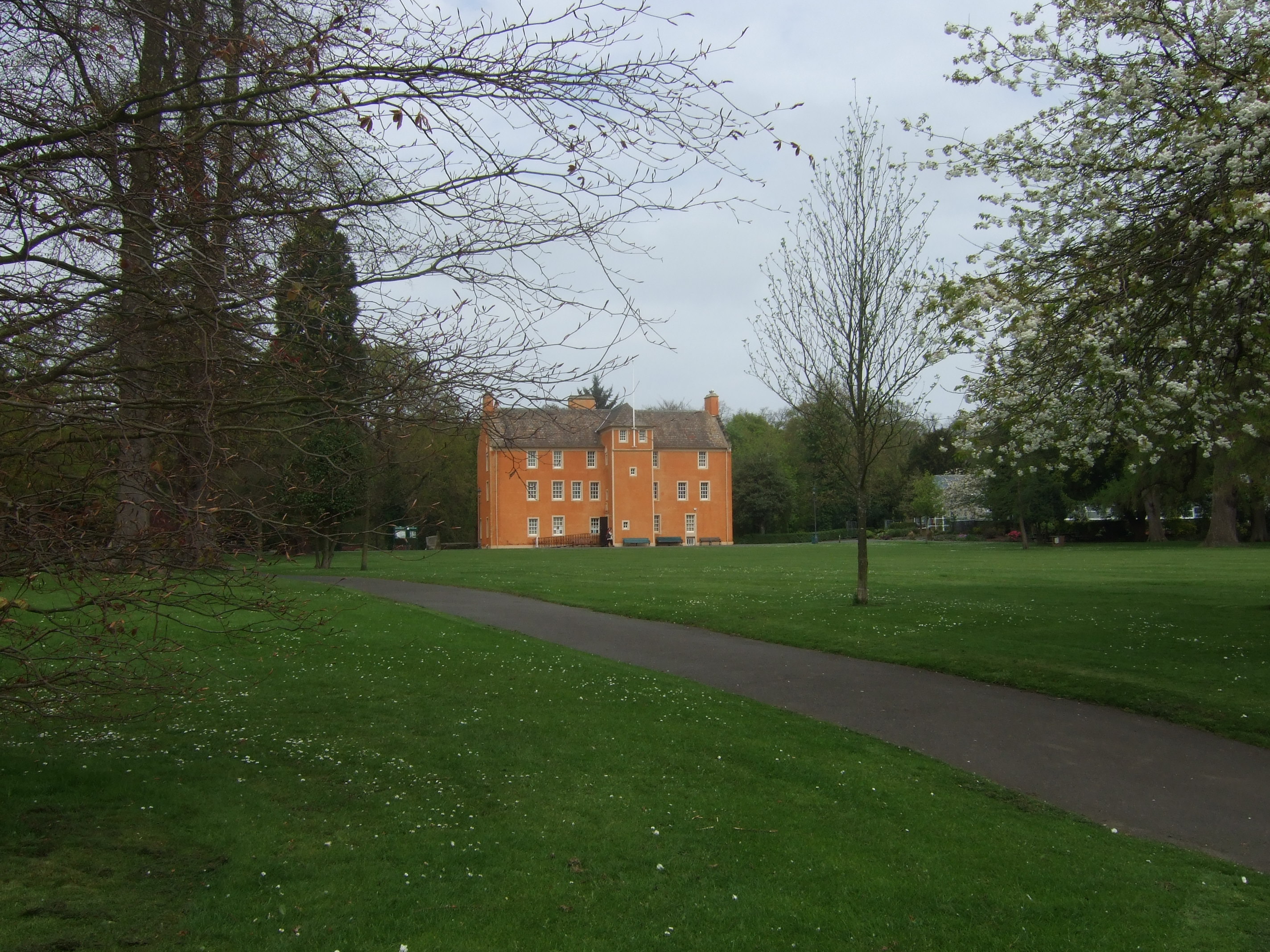
Follow quiet road (no footpath) for 200 m to cemetery, then turn left onto path signposted “Leckerstone and Grange path” with smaller purple arrow below (signifying a Fife Core Path). Follow this path 1000 m until small wood where path divides. Take path signposted with purple arrow through wooden gate and continue through woods and open country for 500 m until you arrive on farm Road. Turn right (follow purple arrow) uphill for 400 m to Wester Gellet (large yellow house on right) and turn left (signposted with purple arrow) and past farm building uphill for 200 m when you will once again get a view of Dunfermline. Continue downhill for 200 m until you arrive on Limekilns road when you turn right along this busy road with a narrow footpath. Proceed north along road for about 400 m when you will get a superb view of the abbey. Then downhill for 400 m over the railway track and then another 500 m through the suburbs of Dunfermline to the big green gates of Pittencrieff Park. At the entrance to the park you will see the notice boards showing the various monuments. Take the road going left and keep left for about 400 m when you will arrive at the Peabody tearooms. You are now on the old pilgrim trail from the West. You may want to spend some time in Pittencrieff Park looking at the various monuments including the museum (fee admission) in Pittencrieff House, the large orange building.
Proceed easterly along the path and down over a bridge past the remnants of Malcolm Canmore’s palace and then out of the park where you can walk round or visit Dunfermline Abbey, the burial ground of Queen Margaret and seven Scottish kings including Robert the Bruce and the old royal palace where Charles 1 was born. Check visitdunfermline.com for abbey opening hours. Nearby is Queen Margaret’s cave.
There is an Information Centre off the High Street in Dunfermline. Also there are various organisations which provide short guided tours. An example is http://www.discoverdunfermline.com/.
There is no recommended alternative walking route back to North Queensferry so we recommend that you return by bus. The bus station is about 300m from the Abbey off Bruce Street.
Please note that not all buses take bikes. The alternative is for cyclists to take the direct route back along the busy bus route.
- -:--
- Duration
- 18.7 km
- Distance
- 195 m
- Ascent
- 197 m
- Descent
- ---
- Avg. speed
- ---
- Avg. speed
Route highlights
Points of interest along the route

Point of interest after 0.7 km
The Queensferry Crossing

Point of interest after 3 km
Well preserved sixteenth century dovecot, with a crow-stepped gable roof, with carved heads at two corners. Internally it has a barrel vaulted ceiling.

Point of interest after 3 km
Rosyth Castle originally was built on a small island in the Firth of Forth accessible only at low tide, and dates from around 1450. The original tower house (58 feet high) was enlarged and extended in the 16th and early 17th centuries. In 1572 it was attacked by men from Blackness Castle across the Firth of Forth and was occupied in 1651 by Oliver Cromwell's army after the Battle of Inverkeithing. As a result of land reclamation the castle lost its waterfront position, becoming marooned on dry land.

Point of interest after 3.7 km
Shiny steel ship building by roundabout

Point of interest after 4.7 km
Signpost by pagoda building
Point of interest after 6.7 km
Turning for Douglas cemetry

Point of interest after 6.9 km
Douglas Bank Cemetery. This cemetery was designated for the burial and commemoration of service men and women who lost their lives serving their country and is maintained in conjunction with the Commonwealth War Graves commission.

Point of interest after 7.5 km
Signposted Gate

Point of interest after 8.4 km
Wester Gellet

Point of interest after 10.2 km
Gates to Pittencrieff Park

Point of interest after 11.4 km
Pittencrieff House is a 17th century house which was transformed into a museum by Robert Lorimer when Andrew Carnegie gave Pittencrieff Park to Dunfermline in 1903. The exterior of the house was authentically restored in 2010, its 400th anniversary. Magic of the Glen exhibition tells the story of the Park from dinosaurs to modern times.

Point of interest after 11.7 km
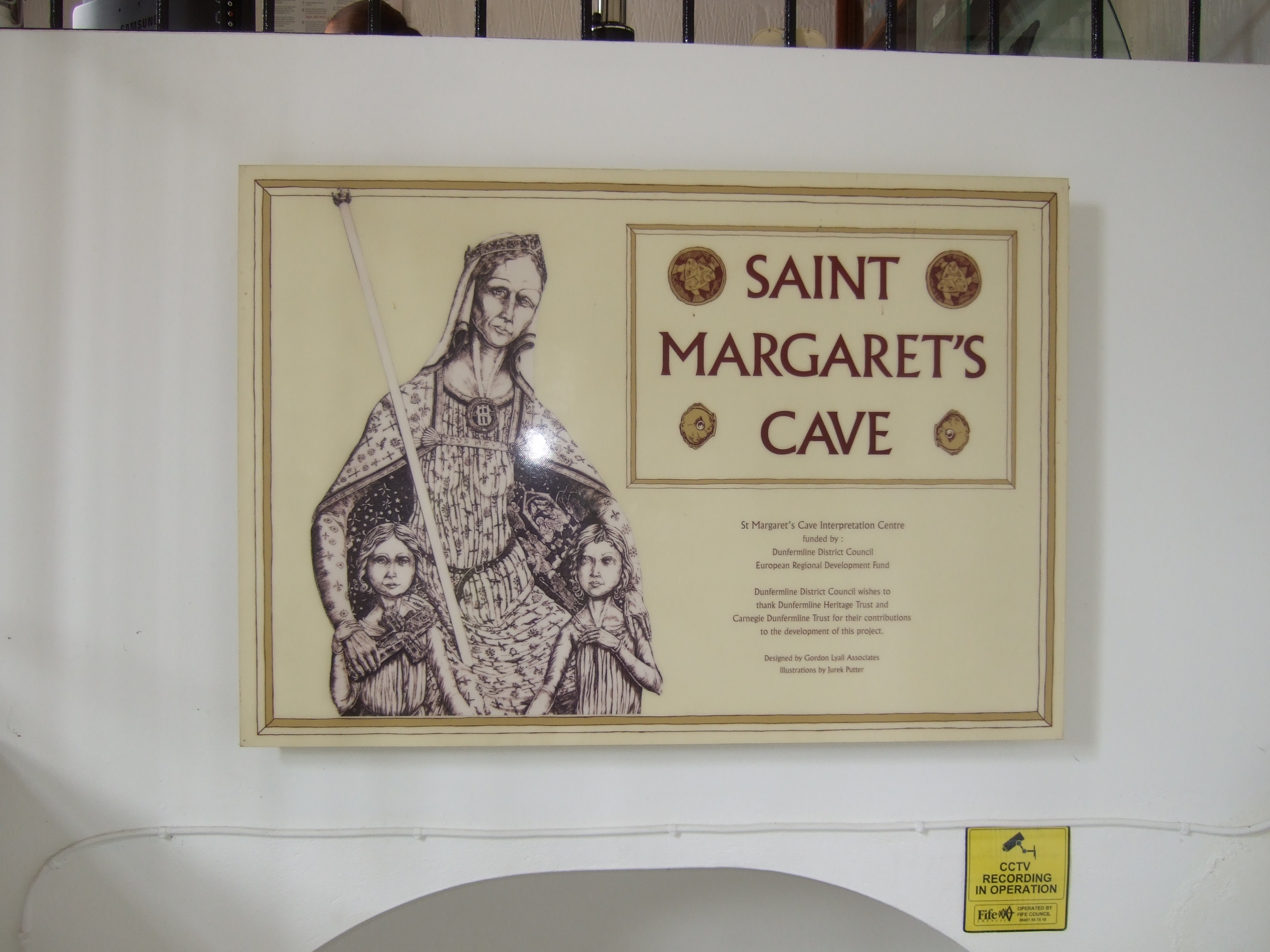
This small cave is associated with Queen (and Saint) Margaret who came here to pray. The cave is one of Scotland's holy shrines and has been long a place of pilgrimage

Point of interest after 11.7 km
The original priory founded by Queen Margaret, wife of Malcolm Canmore, King of Scots was re-established as an abbey by her son in 1128. The abbey is the final resting place of King Robert Bruce and seven other Scottish kings.
Continue with Bikemap
Use, edit, or download this cycling route
You would like to ride St Margaret's Loop (To Dunfermline) or customize it for your own trip? Here is what you can do with this Bikemap route:
Free features
- Save this route as favorite or in collections
- Copy & plan your own version of this route
- Sync your route with Garmin or Wahoo
Premium features
Free trial for 3 days, or one-time payment. More about Bikemap Premium.
- Navigate this route on iOS & Android
- Export a GPX / KML file of this route
- Create your custom printout (try it for free)
- Download this route for offline navigation
Discover more Premium features.
Get Bikemap PremiumFrom our community
Other popular routes starting in North Queensferry
 North_Queensferry_Portobello
- Distance
- 34 km
- Ascent
- 276 m
- Descent
- 278 m
- Location
- North Queensferry, Scotland, United Kingdom
 St Margaret's Loop (To Dunfermline)
- Distance
- 18.7 km
- Ascent
- 195 m
- Descent
- 197 m
- Location
- North Queensferry, Scotland, United Kingdom
 A9000, North Queensferry, Inverkeithing to 10/5 Albion Gardens, Edinburgh
- Distance
- 22.3 km
- Ascent
- 214 m
- Descent
- 226 m
- Location
- North Queensferry, Scotland, United Kingdom
 Mental Health Week Route
- Distance
- 117.6 km
- Ascent
- 356 m
- Descent
- 348 m
- Location
- North Queensferry, Scotland, United Kingdom
 Forth to Seahouses
- Distance
- 178.6 km
- Ascent
- 610 m
- Descent
- 640 m
- Location
- North Queensferry, Scotland, United Kingdom
 Battery Road Turning Circle, North Queensferry to Dovecot Wynd 23
- Distance
- 8.8 km
- Ascent
- 95 m
- Descent
- 105 m
- Location
- North Queensferry, Scotland, United Kingdom
 Brock Street 62, North Queensferry to Port Laing Wynd 1, North Queensferry
- Distance
- 19.6 km
- Ascent
- 340 m
- Descent
- 449 m
- Location
- North Queensferry, Scotland, United Kingdom
 St Margaret's Loop
- Distance
- 11.3 km
- Ascent
- 138 m
- Descent
- 95 m
- Location
- North Queensferry, Scotland, United Kingdom
Open it in the app


