

ABLA-SANTILLANA-CANJAYAR-ALHAMA-DªMARIA-ABLA
A cycling route starting in Abla, Andalusia, Spain.
Overview
About this route
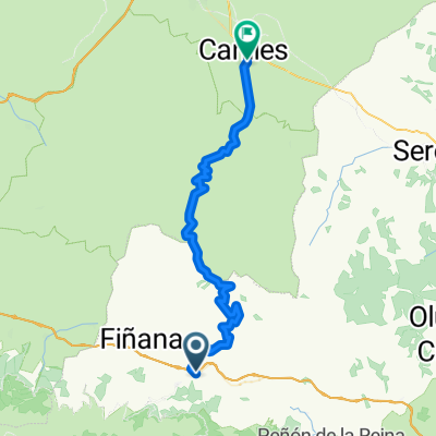
ABLA-SANTILLANA-CANJAYAR-ALHAMA-DªMARIA-ABLA
- -:--
- Duration
- 107.6 km
- Distance
- 1,660 m
- Ascent
- 1,667 m
- Descent
- ---
- Avg. speed
- ---
- Max. altitude

Route quality
Waytypes & surfaces along the route
Waytypes
Quiet road
42.2 km
(39 %)
Road
33.2 km
(31 %)
Surfaces
Paved
28.5 km
(27 %)
Unpaved
1.3 km
(1 %)
Asphalt
28.5 km
(27 %)
Gravel
1.3 km
(1 %)
Undefined
77.9 km
(72 %)
Continue with Bikemap
Use, edit, or download this cycling route
You would like to ride ABLA-SANTILLANA-CANJAYAR-ALHAMA-DªMARIA-ABLA or customize it for your own trip? Here is what you can do with this Bikemap route:
Free features
- Save this route as favorite or in collections
- Copy & plan your own version of this route
- Split it into stages to create a multi-day tour
- Sync your route with Garmin or Wahoo
Premium features
Free trial for 3 days, or one-time payment. More about Bikemap Premium.
- Navigate this route on iOS & Android
- Export a GPX / KML file of this route
- Create your custom printout (try it for free)
- Download this route for offline navigation
Discover more Premium features.
Get Bikemap PremiumFrom our community
Other popular routes starting in Abla
 ABLA-SANTILLANA-OHANES-CANJAYAR-BEIRES-OHANES-ABLA
- Distance
- 67.4 km
- Ascent
- 1,607 m
- Descent
- 1,581 m
- Location
- Abla, Andalusia, Spain
 ABLA-CANILES
- Distance
- 56.3 km
- Ascent
- 1,237 m
- Descent
- 1,160 m
- Location
- Abla, Andalusia, Spain
 Abla Abrucena Ohanes
- Distance
- 56.1 km
- Ascent
- 1,294 m
- Descent
- 1,289 m
- Location
- Abla, Andalusia, Spain
 ABLA-SANTILLANA-CANJAYAR-ALHAMA-DªMARIA-ABLA
- Distance
- 107.6 km
- Ascent
- 1,660 m
- Descent
- 1,667 m
- Location
- Abla, Andalusia, Spain
 Subida a la roza
- Distance
- 10.6 km
- Ascent
- 699 m
- Descent
- 248 m
- Location
- Abla, Andalusia, Spain
 Escullar Haza del Riego Circular
- Distance
- 31.5 km
- Ascent
- 907 m
- Descent
- 896 m
- Location
- Abla, Andalusia, Spain
 Abriendo caminos (Sierra de Escúllar)
- Distance
- 60.6 km
- Ascent
- 1,173 m
- Descent
- 1,169 m
- Location
- Abla, Andalusia, Spain
 Abla-Canjayar-Almeria
- Distance
- 63.8 km
- Ascent
- 826 m
- Descent
- 1,567 m
- Location
- Abla, Andalusia, Spain
Open it in the app