- 47.9 km
- 991 m
- 999 m
- Martigny-Ville, Valais, Switzerland
TVAo final 2014
A cycling route starting in Martigny-Ville, Valais, Switzerland.
Overview
About this route
With GPM and sprints
- -:--
- Duration
- 161.1 km
- Distance
- 4,192 m
- Ascent
- 2,754 m
- Descent
- ---
- Avg. speed
- ---
- Max. altitude
created this 11 years ago
Route quality
Waytypes & surfaces along the route
Waytypes
Quiet road
66 km
(41 %)
Road
49.9 km
(31 %)
Surfaces
Paved
77.3 km
(48 %)
Unpaved
3.2 km
(2 %)
Asphalt
75.7 km
(47 %)
Paved (undefined)
1.6 km
(1 %)
Route highlights
Points of interest along the route
Point of interest after 31.7 km
Sprint Cash 1 : Fully "Les Fol'terres"
Point of interest after 47.6 km
GPM 1 "Ovronnaz" : 2e cat
Point of interest after 58.3 km
Sprint cash 2 à Riddes : "Garage Monet-Gonon Saxon"
Point of interest after 77.8 km
GPM 1e cat. : Col du Lein "Verbier - St Bernard"
Point of interest after 98.6 km
GMP 1e cat. : col des Planches "Sogecoma"
Point of interest after 121 km
GPM 1e cat. : "Fleutry sports"
Continue with Bikemap
Use, edit, or download this cycling route
You would like to ride TVAo final 2014 or customize it for your own trip? Here is what you can do with this Bikemap route:
Free features
- Save this route as favorite or in collections
- Copy & plan your own version of this route
- Split it into stages to create a multi-day tour
- Sync your route with Garmin or Wahoo
Premium features
Free trial for 3 days, or one-time payment. More about Bikemap Premium.
- Navigate this route on iOS & Android
- Export a GPX / KML file of this route
- Create your custom printout (try it for free)
- Download this route for offline navigation
Discover more Premium features.
Get Bikemap PremiumFrom our community
Other popular routes starting in Martigny-Ville
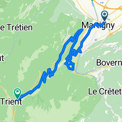
- Place Centrale nach Rue des Follaterres
- La Forclaz buissonnière
- 22.2 km
- 1,689 m
- 627 m
- Martigny-Ville, Valais, Switzerland
- TVAo final
- 121.3 km
- 3,033 m
- 2,391 m
- Martigny-Ville, Valais, Switzerland
- Martigny-Chiboz-Ovronnaz
- 21.3 km
- 1,214 m
- 418 m
- Martigny-Ville, Valais, Switzerland
- [Martigny_000] Col de Champex et Val-Ferret.
- 76.4 km
- 1,840 m
- 1,838 m
- Martigny-Ville, Valais, Switzerland
- Jumelage 2015, étape 1
- 127.6 km
- 1,987 m
- 2,149 m
- Martigny-Ville, Valais, Switzerland
- Jumelage 2015 : Parcours complet
- 581.3 km
- 5,271 m
- 5,308 m
- Martigny-Ville, Valais, Switzerland
- Martigny - Forclaz - Emosson - Finhaut
- 39 km
- 1,924 m
- 1,164 m
- Martigny-Ville, Valais, Switzerland
Open it in the app


![[Martigny_000] Col de Champex et Val-Ferret.](https://media.bikemap.net/routes/7802103/staticmaps/in_50343d82-7cdf-4842-81aa-20a7820b2b4b_400x400_bikemap-2021-3D-static.png)


