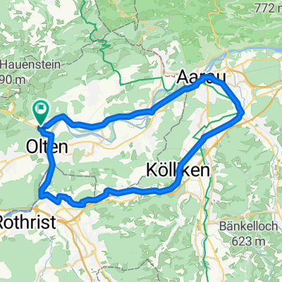

Rumpel
- 3.8 km
- 9 m
- 329 m
- Trimbach, Canton of Solothurn, Switzerland
A cycling route starting in Trimbach, Canton of Solothurn, Switzerland.
Overview
2 juicy passes, beautiful countryside route
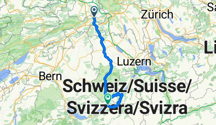
Route quality
Road
29.5 km
(25 %)
Quiet road
7.1 km
(6 %)
Paved
53.1 km
(45 %)
Asphalt
50.7 km
(43 %)
Paved (undefined)
2.4 km
(2 %)
Undefined
64.9 km
(55 %)
Continue with Bikemap
You would like to ride Olten-Entlebuch-Sörenberg-Giswil-Brünig-Brienz or customize it for your own trip? Here is what you can do with this Bikemap route:
Free trial for 3 days, or one-time payment. More about Bikemap Premium.
Discover more Premium features.
Get Bikemap PremiumFrom our community
Open it in the app