

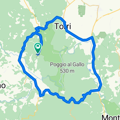
r67km Monticaino
A cycling route starting in Monticiano, Tuscany, Italy.
Overview
About this route
monticiano
- -:--
- Duration
- 66.8 km
- Distance
- 874 m
- Ascent
- 875 m
- Descent
- ---
- Avg. speed
- ---
- Max. altitude

Route quality
Waytypes & surfaces along the route
Waytypes
Road
18.3 km
(27 %)
Busy road
18 km
(27 %)
Surfaces
Paved
27.1 km
(41 %)
Unpaved
21 km
(31 %)
Asphalt
27 km
(40 %)
Unpaved (undefined)
7.1 km
(11 %)
Continue with Bikemap
Use, edit, or download this cycling route
You would like to ride r67km Monticaino or customize it for your own trip? Here is what you can do with this Bikemap route:
Free features
- Save this route as favorite or in collections
- Copy & plan your own version of this route
- Sync your route with Garmin or Wahoo
Premium features
Free trial for 3 days, or one-time payment. More about Bikemap Premium.
- Navigate this route on iOS & Android
- Export a GPX / KML file of this route
- Create your custom printout (try it for free)
- Download this route for offline navigation
Discover more Premium features.
Get Bikemap PremiumFrom our community
Other popular routes starting in Monticiano
 Pentolina Ciciano
- Distance
- 47.7 km
- Ascent
- 574 m
- Descent
- 575 m
- Location
- Monticiano, Tuscany, Italy
 Pentolina - Sovicielle - Montagnola Sense
- Distance
- 30.6 km
- Ascent
- 507 m
- Descent
- 486 m
- Location
- Monticiano, Tuscany, Italy
 San Gimignano - Volterra
- Distance
- 62.8 km
- Ascent
- 1,083 m
- Descent
- 855 m
- Location
- Monticiano, Tuscany, Italy
 Pentolina-kleineHausrunde55km
- Distance
- 54.8 km
- Ascent
- 653 m
- Descent
- 653 m
- Location
- Monticiano, Tuscany, Italy
 Frosini - Cornocchia - Belforte - Montalcinello
- Distance
- 31.3 km
- Ascent
- 667 m
- Descent
- 668 m
- Location
- Monticiano, Tuscany, Italy
 r67km Monticaino
- Distance
- 66.8 km
- Ascent
- 874 m
- Descent
- 875 m
- Location
- Monticiano, Tuscany, Italy
 Pentolina-PonteSantaGuila-Casole D'Elsa-CasaSanDonato-Monteguidi-Cerbaiola-Paganina-Montegegnoli-Montalcinello-Casino-Chiusdino-Palazetto-Pentolina
- Distance
- 104.1 km
- Ascent
- 1,167 m
- Descent
- 1,167 m
- Location
- Monticiano, Tuscany, Italy
 Pentolina Montalcinello
- Distance
- 63.8 km
- Ascent
- 796 m
- Descent
- 796 m
- Location
- Monticiano, Tuscany, Italy
Open it in the app