

Werra Herleshausen - ESW
A cycling route starting in Lauchröden, Thuringia, Germany.
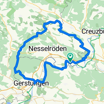
Overview
About this route
Arrival to Herleshausen with Cantus.
Return from the city station ESW- -:--
- Duration
- 57.8 km
- Distance
- 363 m
- Ascent
- 398 m
- Descent
- ---
- Avg. speed
- ---
- Max. altitude
Route quality
Waytypes & surfaces along the route
Waytypes
Quiet road
5.2 km
(9 %)
Access road
0.6 km
(1 %)
Surfaces
Paved
48 km
(83 %)
Asphalt
46.8 km
(81 %)
Paved (undefined)
1.2 km
(2 %)
Undefined
9.8 km
(17 %)
Continue with Bikemap
Use, edit, or download this cycling route
You would like to ride Werra Herleshausen - ESW or customize it for your own trip? Here is what you can do with this Bikemap route:
Free features
- Save this route as favorite or in collections
- Copy & plan your own version of this route
- Sync your route with Garmin or Wahoo
Premium features
Free trial for 3 days, or one-time payment. More about Bikemap Premium.
- Navigate this route on iOS & Android
- Export a GPX / KML file of this route
- Create your custom printout (try it for free)
- Download this route for offline navigation
Discover more Premium features.
Get Bikemap PremiumFrom our community
Other popular routes starting in Lauchröden
 Herleshausen Hann Münden 2 Tag
- Distance
- 117.6 km
- Ascent
- 164 m
- Descent
- 232 m
- Location
- Lauchröden, Thuringia, Germany
 auf Grenzerwegen um Herleshausen
- Distance
- 54.7 km
- Ascent
- 777 m
- Descent
- 777 m
- Location
- Lauchröden, Thuringia, Germany
 Werra Herleshausen - ESW
- Distance
- 57.8 km
- Ascent
- 363 m
- Descent
- 398 m
- Location
- Lauchröden, Thuringia, Germany
 Unterellen - Vachaer Stein
- Distance
- 21.3 km
- Ascent
- 265 m
- Descent
- 265 m
- Location
- Lauchröden, Thuringia, Germany
 2016-09-10: WTR - REN
- Distance
- 80.8 km
- Ascent
- 569 m
- Descent
- 560 m
- Location
- Lauchröden, Thuringia, Germany
 Werra Radweg Herleshausen - ESW
- Distance
- 75.8 km
- Ascent
- 445 m
- Descent
- 488 m
- Location
- Lauchröden, Thuringia, Germany
 joggen in unterellen
- Distance
- 12.9 km
- Ascent
- 214 m
- Descent
- 217 m
- Location
- Lauchröden, Thuringia, Germany
 2. Etappe Badetag unter 100 km
- Distance
- 111.5 km
- Ascent
- 751 m
- Descent
- 815 m
- Location
- Lauchröden, Thuringia, Germany
Open it in the app